Putha Hiunchuli: Nepal’s Westernmost 7,000 m Peak
-----------------Introduction---------------
Himalayan peak in the Dhaulagiri Himal, spanning Dolpa, Myagdi, and Rukum districts, western Nepal.
Highest peak: Putha Hiunchuli (7,246 m), also known as Dhaulagiri VII, first climbed in 1954 by J.O.M. Roberts and Ang Nyima Sherpa.
Located at the western end of the Dhaulagiri II chain, within the Dhorpatan Hunting Reserve.
Remote, with limited ascents since its opening, offering a challenging mountaineering experience.
-----------Geographical Features--------------
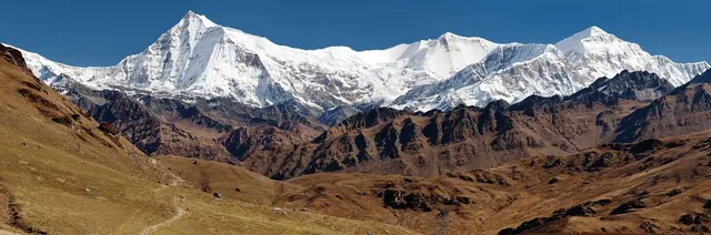
Elevation: 7,246 m; Dhaulagiri range spans 1,500–8,167 m.
Features inclined ice walls, glaciers, and rugged ridges, with a prominence of 1,151 m.
Bordered by the Bheri River (west), Myagdi Khola (southeast), and Dolpo region (north).
Part of a massif separating Dolpo from Dhaulagiri I, with steep northern and northeastern faces.
-----------Tourism and Activities----------------
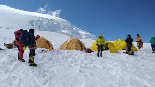
Mountaineering: Technical climbs via North or Northeast Face, with the North route (35° glacier slope) being safer.
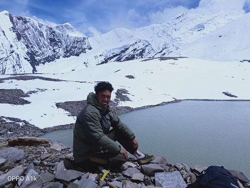
Trekking: Approaches via Dhorpatan Valley or Dolpo (10–14 days), often starting from Dunai.
Appeals to climbers seeking a remote 7,000 m peak with fewer crowds than Annapurna or Everest.
Wildlife spotting (blue sheep, Himalayan tahr) and cultural visits to Dolpo villages.
---------Socio-Cultural Significance-----------
Dolpo and Rukum communities, primarily Tibetan-Buddhist and Magar, preserve ancient traditions.
Cultural highlights: Dunai’s monasteries, Magar villages, and sacred sites in Dhorpatan.
Tourism supports local economies and the Dhorpatan Hunting Reserve’s conservation efforts.
Respect sacred mountains, avoid restricted hunting zones, and honor local customs.
---------Climate Change Impact---------
Glacial retreat in Dhaulagiri Himal reduces water flow in Bheri and Myagdi Khola rivers.
Warming threatens high-altitude species like snow leopards and Himalayan tahr.
Dhorpatan Reserve promotes sustainability, but funding and remoteness limit conservation.
Monsoon-driven landslides and glacial melt increase risks on climbing routes.
--------How to Get There------------
By Air: Fly from Kathmandu to Nepalgunj (1 hr), then to Juphal (35 min) for Dolpo access.
By Road: Drive from Nepalgunj to Dunai (8–10 hrs), the trekking starting point.
Trekking: Dunai to Putha Hiunchuli Base Camp (10–14 days) via Dhorpatan or Dolpo routes.
Permits: Restricted Area Permit for Dolpo (~USD 20–30/week); Dhorpatan entry fees (NPR 3,000 for...
Read more