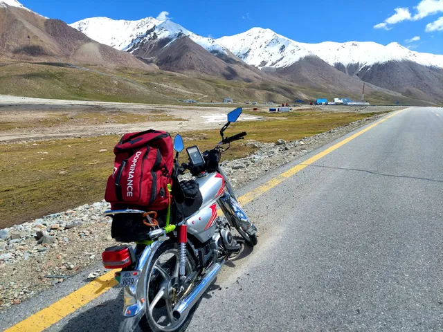
Khunjerab Pass (sometimes called Khunerjab Pass) is a high mountain pass on the northern border of Pakistan with China, at an elevation of 4.733m (15,528ft) above the sea level. The Khunjerab Pass is the highest border-crossing in the world and the highest point on the Karakoram Highway.
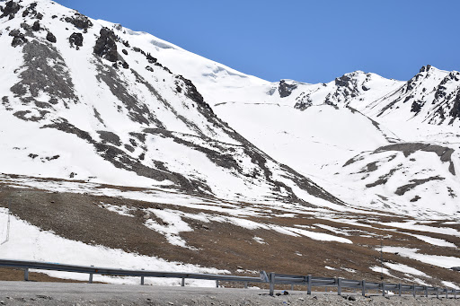
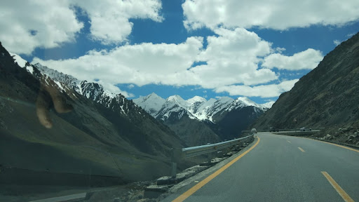
Khunjerab Pass is located in the Karakoram Mountains in a strategic position on the northern border of Pakistan's Gilgit–Baltistan Hunza-Nagar District on the southwest border of the Xinjiang region of China. For comparison, Mont Blanc, the tallest mountain in Western Europe, is 4.810 m and Mount Whitney, the highest point in the 48 contiguous United States, is 4.421. This section of the road was completed in 1982 and is possibly the highest metalled border crossing in the world. On the Pakistani side, the surface of the road is gravel. On the Chinese side, the surface of the road is a bad asphalt
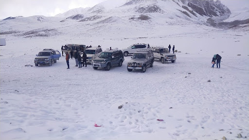
During the rainy season (December-April), because of mudslides the pass is closed to all vehicles except large trucks. The long, relatively flat pass is often snow-covered during the winter season and as a consequence is generally closed from November 30 to May 1. Choose your time carefully. The road bad conditions, with extremely large pot holes could potentially pop a tire, crack a rim, or screw up your cars allignment. Portions of the road may be temporarily closed due to road work or inclement weather. Heavy or prolonged rain can cause local flash floods that cover the road with water or wash out culverts or bridges. There are some police checkpoints along the highway in China that may slow down your journey significantly if there are many cars and trucks. It is not advisable to take cars, 4x4 is preferred but a Van / coaster would serve the purpose.The unpaved sections of the road can be impassable when wet. In any case, driving 4WD is recommended due to uneven surface. During and after a storm the road may be impassable, even with a four-wheel-drive vehicle and can easily get muddy if it rains making it challenging to get through. It’s a tough terrain and expect landslides during rainy season. Watch out for sudden loose-gravel breaks. And that pavement can ripple like a roller coaster track in places where “frost heaves” are caused by seasonal freezing and thawing of the ground. The surface on this gravel road is often loose, especially along the sides of the road. It makes necessary to drive carefully and slow down whenever approaching an oncoming car. Besham is the start of Kohsitan which is famous for its ruggedness and stubbornness. It is highly advisable to limit your stay and keep going preferably during day time. Kohistan borders Baltistan which is relatively safe. Main town to stay...
Read moreKhunjerab Pass is a mountain pass in northern Pakistan that lies at an elevation of 4,693 metres (15,397 ft) above sea level. It is located in the Karakoram and holds a significant strategic position on the northern border of Pakistan, specifically in the Gilgit-Baltistan's Hunza and Nagar Districts. Additionally, it is positioned on the southwestern border of China, within the Xinjiang region. The word "خنجراب" in the local Wakhi language means 'waterfall house'. It is derived from two words, "خون"-"Khun" means house and "جراب"-"Jerab" means a creek coming from a spring or a waterfall. The Khunjerab Pass holds several distinctions, including being the highest paved international border crossing globally and serving as the highest point along the Karakoram Highway. The construction of the road across this pass was completed in 1982, and it has since supplanted the previously unpaved Mintaka and Kilik passes as the principal route across the formidable Karakoram Range. The decision to use the Khunjerab Pass for the Karakoram Highway was made in 1966. China citing the fact that Mintaka would be more susceptible to air strikes, recommended the steeper Khunjerab Pass instead. On the Pakistani-administered side, the pass is 42 km (26 mi) from the National Park station and checkpoint in Dih, 75 km (47 mi) from the customs and immigration post in Sost, 270 km (170 mi) from Gilgit, and 870 km (540 mi) from Islamabad. On the Chinese side, the pass is the southwest terminus of China National Highway 314 (G314) and is 130 km (81 mi) from Tashkurgan, 420 km (260 mi) from Kashgar and 1,890 km (1,170 mi) from Urumqi. The Chinese port of entry is located 3.5 km (2.2 mi) along the road from the pass in Tashkurgan County. The long, relatively flat pass is often snow-covered during the winter season and as a consequence is generally closed for heavy vehicles from November 30 to May 1 and for all vehicles from December 30 to April 1. This is not set however, late snowfall in the region attributed to climate-change means the road is accessible even during the winter months. Depending on the amount of snowfall, the road is cleared from time periods ranging from days to weeks. Since June 1, 2006, there has been a daily bus service across the boundary from Gilgit to Kashgar, Xinjiang The Pakistani side features the highest ATM in the world, administered by the National Bank of Pakistan and linked to China UnionPay and the domestic...
Read moreA amazing experience for the tourists visiting Hunza and a must go place to see the friendly border between Pakistan and china with beautiful views and you will find snow there even in summers.
Health tips: Take some dried apricots from Hunza bazar before going to Khunjarav Top. Persons with asthma problems are suggested no to visit this place as there is less oxygen due to high altitude. You may suffer altitude skiness (specially people visiting from sea levels) Incase of facing breathing problem quickly get back to Sost.
Travelling tips: Plz make sure to hire some expert drivers or local drivers as the road has sharp turns and slopes. Due to high altitude the vehicle breaks won't work properly so don't relay on breaks and use low gears...
Read more