Ojstrica alternative route via Skarje - Difficulty: advanced. Date: June 18th 2025
The day before this hike I was told that the regular route up the ojstrica was not safe because of unstable ice. Because of this I decided to take the alternative route that goes around the back of the mountain.
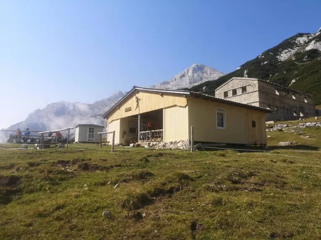
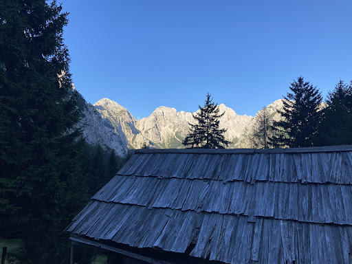
The day started with a hike towards the mountain hut, this is about 400 meters up. This is a nice place to have a coffee break or enjoy a beer on the way back. This part of the hike has little exposure and only small amounts of via ferrata.
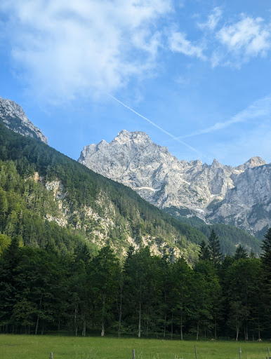
When going further up you'll start exiting the forest and enter these giant fields of scree, there was quite some sun but also plenty of shade, one problem is that the route markings are mostly faded from here on out. the hike started getting a bit steeper and we then encountered the first ice sheet we had to cross, at this time of year you still have to cross a few of them here and there.
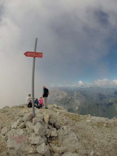
After this we started getting close to the Skarje peak, the mountain we had to climb before getting to the Ojstrica. The last few hundred meters required some scrambling but this was not too hard. When you arrive at this peak you already have great views of the valley, here you can decide to go down to the valley at the other side or continue climbing to the peak of Ojstrica.
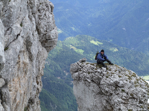
This is where the advanced part comes. When you start the climb towards the peak you first have to pass a difficult ice patch & a very exposed via ferrata section that runs past the face of the mountain, you cannot make any mistakes here. You can skip this section by first going down to the other valley and then taking a turn right for the other back route towards the Ojstrica, this will take you an extra hour 1 way though.
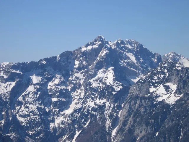
After the two roads come together again the final climb is not too difficult, it again involves scrambling but now only up to an intermediate level. When you arrive at the top you will have some of the best views in all of slovenia. As Ojstrica is one of the highest mountains in the area you can see very far away. On a good day you can even see the julian alps. In the end it is all worth it.
On my way down I took the detour route mentioned earlier, it was also a very nice route passing the valley laying behind Logarska
Dolina. I do believe that when all the ice is melted it is definitely best to take the front route, it's less advanced and takes a shorter amount of time.
This hike is definitely not for everyone. You need to come well prepared with good boots and sticks being the bare minimum. You also need to have a good amount of experience in hiking and mountaineering, it's 1600 meters up so it definitely isn't easy but doable. Dont forget that good weather is critical, do not go up on days with the risk of rain.
In the end I think this was one of the most beautiful and challenging hikes I ever did. Of course it was all worth it and i am sure I will come back to climb more of the beautiful mountains in the Logarska...
Read more