šš°š±š»š“ š¼š¾šš½šš°šøš½, šš¾ššš· š°šµššøš²š°
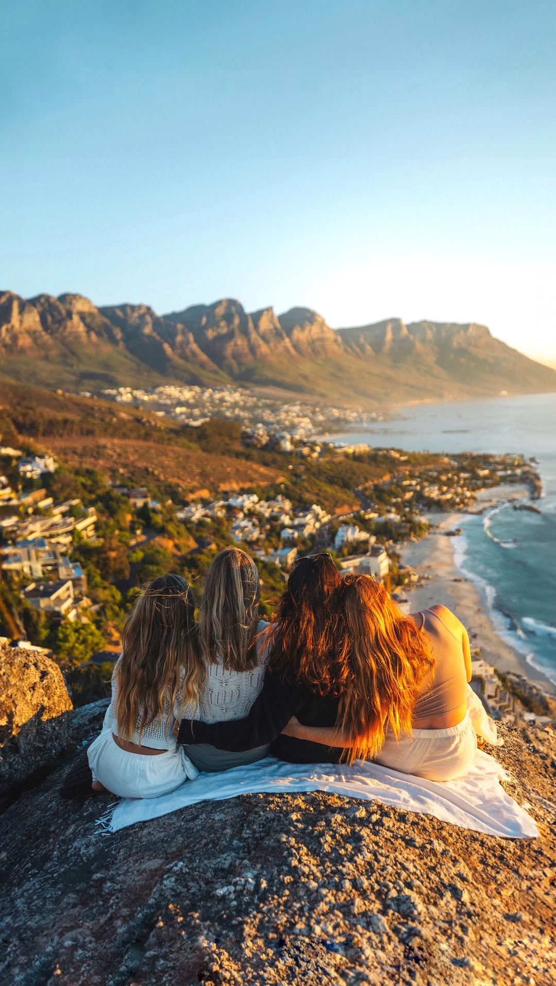
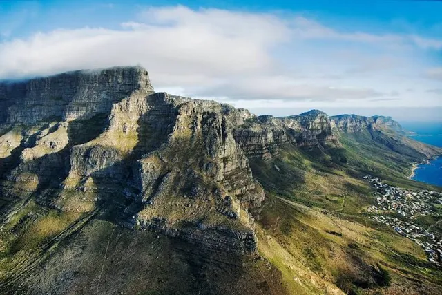
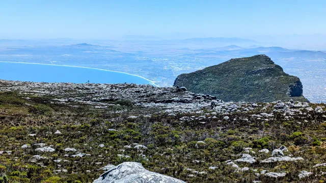
Table Mountain is a flat-topped mountain forming a prominent landmark overlooking the city of Cape Town in South Africa. It is a significant tourist attraction, with many visitors using the cableway or hiking to the top.
The mountain forms part of the Table Mountain National Park, and part of the lands formerly ranged by Khoe-speaking clans, such as the !UriĒŹ¼aes (the "High Clan"). It is home to a large array of mostly endemic fauna and flora. The main feature of Table Mountain is the level plateau approximately three kilometres (2 mi) from side to side, edged by impressive cliffs. The plateau, flanked by Devil's Peak to the east and by Lion's Head to the west, forms a dramatic backdrop to Cape Town. This broad sweep of mountainous heights, together with Signal Hill, forms the natural amphitheatre of the City Bowl and Table Bay harbour. The highest point on Table Mountain is towards the eastern end of the plateau and is marked by Maclear's Beacon, a stone cairn built in 1865 by Sir Thomas Maclear for trigonometrical survey. It is 1,086 metres (3,563 ft) above sea level, and about 19 metres (62 ft) higher than the cable station at the western end of the plateau.
The cliffs of the main plateau are split by Platteklip Gorge ("Flat Stone Gorge"), which provides an easy and direct ascent to the summit and was the route taken by António de Saldanha on the first recorded ascent of the mountain in 1503.[4]
The flat top of the mountain is often covered by orographic clouds, formed when a southeasterly wind is directed up the mountain's slopes into colder air, where the moisture condenses to form the so-called "table cloth" of cloud. Legend attributes this phenomenon to a smoking contest between the Devil and a local pirate called Van Hunks.
*[5] When the table cloth is seen, it symbolizes the contest.
Table Mountain is at the northern end of a sandstone mountain range that forms the spine of the Cape Peninsula that terminates approximately 50 kilometres (30 mi) to the south at the Cape of Good Hope and Cape Point. Immediately to the south of Table Mountain is a rugged "plateau" at a somewhat lower elevation than the Table Mountain Plateau (at about 1,000 m or 3,300 ft), called the "Back Table". The "Back Table" extends southwards for approximately 6 km to the Constantia Nek-Hout Bay valley. The Atlantic side of the Back Table is known as the Twelve Apostles, which extends from Kloof Nek (the saddle between Table Mountain and Lion's Head) to Hout Bay. The eastern side of this portion of the Peninsula's mountain chain, extending from Devil's Peak, the eastern side of Table Mountain (Erica and Fernwood Buttresses), and the Back Table to Constantia Nek, does not have a single name, as on the western side. It is better known by the names of the conservation areas on its lower slopes: Groote Schuur Estate, Newlands Forest, Kirstenbosch Botanical Gardens, Cecilia Park, and...
Ā Ā Ā Read moreIn December 2019, I visited Table Mountain in Cape Town, and it was easily one of the highlights of my trip. Rising above the city with its unmistakable flat summit, itās a landmark you see everywhere in Cape Town, but nothing compares to actually standing on top of it.
I took the cable car up (which slowly rotates as you ascend, so you get 360° views), and the ride itself was worth it. Once at the summit, the scenery was simply breathtaking: Cape Town stretched out below, the Atlantic Ocean shimmering in the distance, and Robben Island visible offshore. The scale of it all is hard to take in, you feel both small and incredibly alive at the same time.
Walking along the trails on top, I loved how different the views were from each side of the mountain. On one side, you see the city and harbor; on the other, the Twelve Apostles mountain range rolling into the ocean. The contrast of rugged cliffs, blue waters, and sprawling city makes Table Mountain a one-of-a-kind viewpoint.
Tips for future visitors:
Go early in the morning if you can, less crowded and clearer skies.
Weather changes quickly, bring a light jacket even in summer.
If youāre up for it, consider hiking one of the trails either up or down, itās challenging but rewarding.
Table Mountain isnāt just a view, itās an experience that defines Cape Town. Whether youāre looking out over the city, watching clouds roll over the plateau, or simply taking in the vastness of the landscape, itās something youāll...
   Read moreThe main feature of Table Mountain is the level plateau approximately three kilometres (2 mi) from side to side, edged by impressive cliffs. The plateau, flanked by Devil's Peak to the east and by Lion's Head to the west, forms a dramatic backdrop to Cape Town. This broad sweep of mountainous heights, together with Signal Hill, forms the natural amphitheatre of the City Bowl and Table Bay harbour. The highest point on Table Mountain is towards the eastern end of the plateau and is marked by Maclear's Beacon, a stone cairn built in 1865 by Sir Thomas Maclear for trigonometrical survey. It is 1,086 metres (3,563 ft) above sea level, and about 19 metres (62 ft) higher than the cable station at the western end of the plateau. The cliffs of the main plateau are split by Platteklip Gorge ("Flat Stone Gorge"), which provides an easy and direct ascent to the summit and was the route taken by António de Saldanha on the first recorded ascent of the...
Ā Ā Ā Read more