Bathalegala / Bible Rock (797.7m)
Directions: Colombo-Mawanella- Aranayaka- Gewalapitiya-Hathgampola-Bathalegala Road-Bathalegala
Bathalegala is one of famous destinations among travellers as it is an easy hike. It is nicely seen like Sigiriya when you drive up at Kadungannawa. My first visit to Bathalegala happened in 2009 and it was the first hike with Ashan. I still can remember the extreme wind we felt on top of Bathalegala. This was my second visit to Bathalegala after 11 years. Our main objective was to travel to Nuwara Eliya and this was kind of on our way task.
How Bathalegala is seen to nearby other mountains The unique appearance of Bathalegala made easy to identify from nearby mountains.
Early morning we have arrived to Mawanella town then turned to Aranayaka road. Google map gave clear directions to Bathalegala and we stopped at Hathgampola junction to buy some buns. As I mentioned above, the road condition was not that much good at Bathalegala road. Therefore we have parked the vehicle somewhere before the trail head and walked up. (It is about 3Km from Hathgampola junction to trail head) It is almost an ascend from the trail head to top of Bathalegala. First it was stone steps and then cements steps aided by an iron bar. This foot path comes to a mid-point of the rock. If you follow the left side you will end up at view point of Bathalegala while the temple is situated at right side of the rock. There were evidences of camping on top of the rock. As it was a gloomy day we were not able to view that much nearby structures. Samasara Kanda, Kukulpitiya Gala and Ura Kanda were identified through the haziness. In a clear day you can view Kabaragala, Rakshawa Kanda and Asupini Ella in addition to above mentioned mountains.
This time the top was calm compared to my previous visit and it allowed me to fly the drone. We were able to view a different angle of Bathalegala.
Then we followed the same foot path and came to the other end of the rock which is occupied by the temple. There were a lot of constructions at this end and nobody was at the temple at that time. A sign board directed us to a âLen Wiharayaâ which is situated below the rock level. There were two caves at this path and one is converted to a shrine house.
Bo tree and Stupa were situated closer to other end. It was a good place to view Kukulpitiya Gala and Samasara Kanda.
We followed the same foot path in return journey to reach the trail...
   Read moreBatalegala mountain where rice cannot be eaten Alagalle mountain, where potatoes cannot be eaten Hunnasgiri mountain which cannot be eaten by Huna The leader of these three mountains is Samanola Kanda Situated at an altitude of 2618 feet above sea level, this beautiful solitary mountain range is well known among mountaineers.
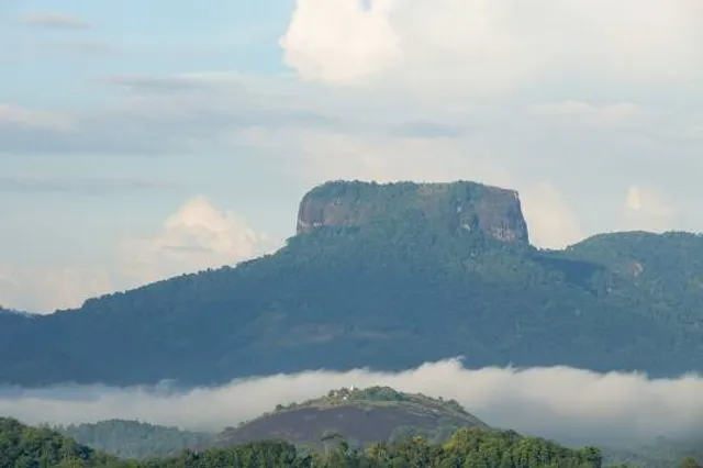
This mountain is about 540 feet high .. It is located close to Aranayaka town in Kegalle district of Sabaragamuwa province ..
At first glance Mount Batalegala looks like a replica of Sigiriya ... This is also known as Little Sigiriya and Bible Rock ..
Today, the Batalegala Bauddhaloka Maha Viharaya has been established on the top of this hill.
There are many legends about Batalegala mountain ..
Batalegala Kanda is a mountain peak located in the plains and was used as a fort to protect the kings of that time.
It is also recorded that Batalegala mountain was used as a center where the army was gathered.
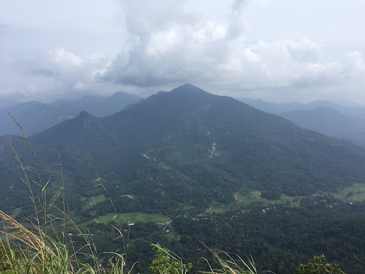
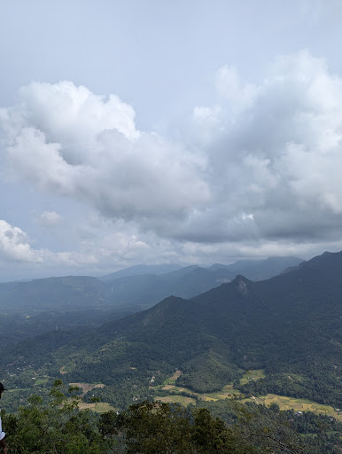
There are streams and rivers flowing through the mountains as well as many endemic trees scattered throughout this beautiful environment ...
The melodious singing of different types of birds adds a uniqueness to this lovely environment ...
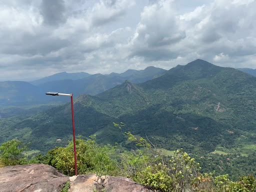
The surroundings at the top of the Batalegala hill are truly breathtaking ...
Climbing Batalegala is not that difficult..the jungle footpaths here are often used by humansâ. So the journey is a bit easier ..
Because there is a Buddhist temple on one side at the top of Batalegala ...
There is another story ...
In 1956, the then Minister of Culture and the villagers got together and planted a sapling of the Sri Maha Bodhi on the top of the hill and called it a weekly Pirith.
Later we came to know that this place is in a state of disrepair without proper maintenance ...
Don't forget to leave only your footprints in this pin ground one day in...
   Read moreBathalegala Rock, often referred to as the "Bible Rock," is a natural marvel located in the central highlands of Sri Lanka. This imposing monolith stands tall at an elevation of 1,300 meters and offers a thrilling adventure for hikers and nature enthusiasts.
The ascent to Bathalegala Rock is not for the faint-hearted. It involves a challenging hike through dense forests, rocky terrain, and steep ascents. However, the breathtaking panoramic views from the summit make every ounce of effort worthwhile. As you reach the top, you'll be greeted by a stunning 360-degree vista of the surrounding lush landscapes, including the picturesque Knuckles Mountain Range.
The rock itself is an intriguing geological formation with unique contours, adding to its mystique. It's also a place of cultural significance, with a history dating back to ancient times, making it a must-visit for history buffs.
The journey to Bathalegala is an eco-adventure, where you'll encounter diverse flora and fauna along the way. Birdwatchers will be delighted by the opportunity to spot various avian species.
However, due to the challenging nature of the hike, it's important to be well-prepared with proper gear, water, and a local guide. Additionally, ensure you visit during the dry season for a safer and more enjoyable experience.
In conclusion, Bathalegala Rock is an extraordinary natural gem in Sri Lanka that promises a rewarding adventure for those willing to conquer its heights. Its stunning views, rich history, and ecological diversity make it a must-visit destination for any traveler seeking an unforgettable experience amidst...
   Read more