San Bernardino Pass things to do, attractions, restaurants, events info and trip planning
Basic Info
San Bernardino Pass
6565 Mesocco, Switzerland
4.8(578)
Save
spot
spot
Ratings & Description
Info
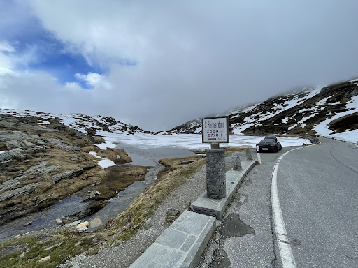
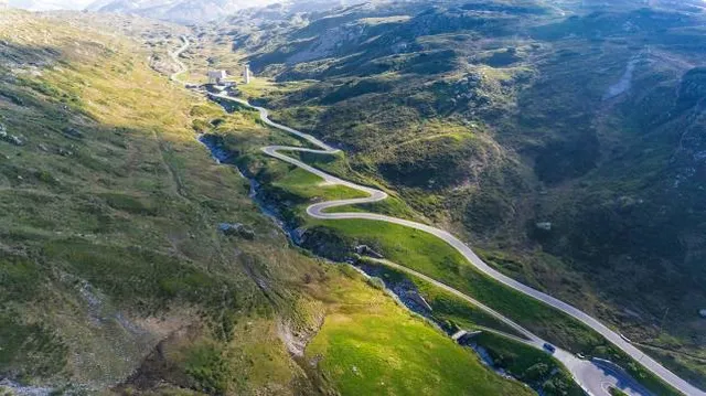
San Bernardino Pass is a high mountain pass in the Swiss Alps connecting the Hinterrhein and the Mesolcina valleys between Thusis and Bellinzona. Located in the far eastern side of the Western Alps it is not to be confused with the Great St Bernard Pass and the Little St Bernard Pass.
Outdoor
Adventure
Scenic
Pet friendly
Off the beaten path
attractions: Laghetto Moesola, restaurants: , local businesses:
Plan your stay

Pet-friendly Hotels in Mesocco
Find a cozy hotel nearby and make it a full experience.

Affordable Hotels in Mesocco
Find a cozy hotel nearby and make it a full experience.

The Coolest Hotels You Haven't Heard Of (Yet)
Find a cozy hotel nearby and make it a full experience.

Trending Stays Worth the Hype in Mesocco
Find a cozy hotel nearby and make it a full experience.
Reviews
Nearby attractions of San Bernardino Pass
Laghetto Moesola
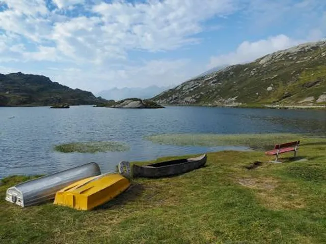
Laghetto Moesola
4.8
(21)
Open 24 hours
Click for details