Phu Khao Luang things to do, attractions, restaurants, events info and trip planning

Basic Info
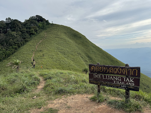
Phu Khao Luang
Nong Bua Nuea, Mueang Tak District, Tak 63000, Thailand
4.7(26)
Save
spot
spot
Ratings & Description
Info
Outdoor
Adventure
Scenic
Off the beaten path
attractions: , restaurants: , local businesses:
Plan your stay

Pet-friendly Hotels in Tak Province
Find a cozy hotel nearby and make it a full experience.

Affordable Hotels in Tak Province
Find a cozy hotel nearby and make it a full experience.

The Coolest Hotels You Haven't Heard Of (Yet)
Find a cozy hotel nearby and make it a full experience.

Trending Stays Worth the Hype in Tak Province
Find a cozy hotel nearby and make it a full experience.