Monday 24th March 2025.
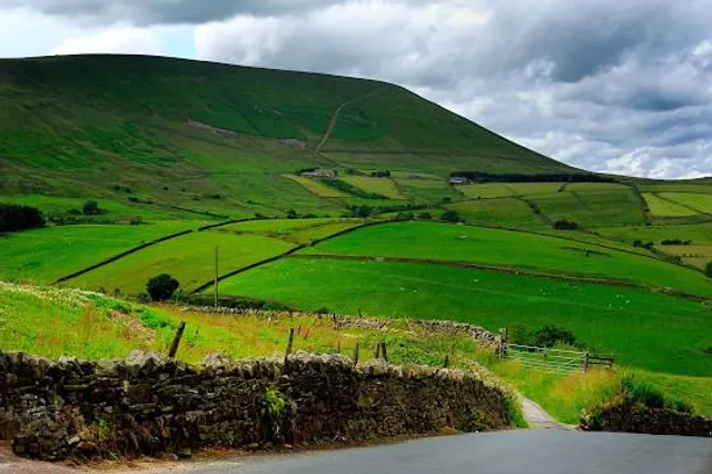
Pendle Hill is in the east of Lancashire, England, near the towns of Burnley, Nelson, Colne, Brierfield, Clitheroe and Padiham. Its summit is 557 metres (1,827 ft) above mean sea level. It gives its name to the Borough of Pendle. It is an isolated hill in the Pennines, separated from the South Pennines to the east, the Bowland Fells to the northwest, and the West Pennine Moors to the south. It is included in a detached part of the Forest of Bowland Area of Outstanding Natural Beauty.
The name "Pendle Hill" combines the words for hill from three different languages. In the 13th century, it was called Pennul or Penhul, apparently from the Cumbric pen and Old English hyll, both meaning "hill." The modern English "hill" was appended later, after the original meaning of Pendle had become opaque.
Neolithic and Bronze Age burial sites have been discovered at and around the summit of the hill.
There is an ancient local legend that the Devil once jumped from Hameldon Hill to an outcrop overlooking Sabden on the southwest slope of Pendle, leaving footprints in the sandstone. Here, he gathered rocks in an apron and, after proceeding the short distance to Apronfull, threw a boulder aimed at Clitheroe Castle. At that moment, the apron string broke, causing the boulder to land near Pendleton and creating the pile of rocks atop the slight prominence there.
The hill is famous for its links to three events which took place in the 17th century: the Pendle witch trials (1612), Richard Towneley's barometer experiment (1661), and the vision of George Fox (1652), which led to the foundation of the Religious Society of Friends (Quaker) movement.
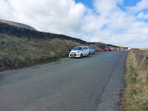
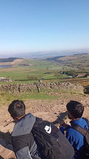
It was a lovely day, the weather was warm and sunny 🌞. It was a very short gradual walk up to the start of the trail, opposite the kiosk, which serves ice cream and snacks, which wasn't open at the time. Then, I started a very steep assent to the summit 😳. I needed to stop at least twenty times and rest on the way up 🥵. I wouldn't say that I was totally unfit, but you really do need to be reasonably fit to attempt this climb. As you will see from the photos, an ambulance 🚑 was present with paramedics attending an elderly lady that had collapsed, a third of the way up, due to raised blood pressure. However, on the way up and certainly at the top at the trig station, the views were really good 👌. I recommend this walk. Suitable for families, not under fives, however, please make sure you have the correct clothing, take some water and snacks, and you are reasonably...
Read more