Moel Famau things to do, attractions, restaurants, events info and trip planning
Basic Info
Moel Famau
Mold CH7 5PH, United Kingdom
4.9(357)
Save
spot
spot
Ratings & Description
Info
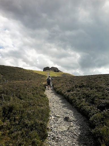
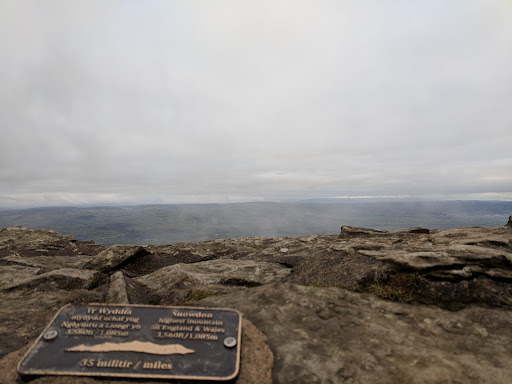
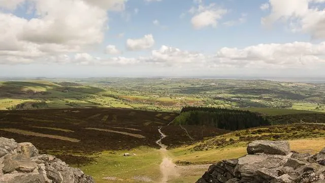
Moel Famau is the highest hill in the Clwydian Range and the highest point of the county of Flintshire in Wales. It lies on the boundary between Denbighshire and Flintshire. The hill, which also gives its name to the Moel Famau country park, has been classed as an Area of Outstanding Natural Beauty since 1985.
Outdoor
Adventure
Scenic
Family friendly
Pet friendly
Off the beaten path
attractions: , restaurants: , local businesses:
Plan your stay

Pet-friendly Hotels in Cilcain
Find a cozy hotel nearby and make it a full experience.

Affordable Hotels in Cilcain
Find a cozy hotel nearby and make it a full experience.

The Coolest Hotels You Haven't Heard Of (Yet)
Find a cozy hotel nearby and make it a full experience.

Trending Stays Worth the Hype in Cilcain
Find a cozy hotel nearby and make it a full experience.
Reviews
Live events
Food-Walk through historic Chester
Wed, Jan 28 • 1:00 PM
Cheshire West and Chester, CH1, United Kingdom
View details

Mindfulness and Meditation for Health and Wellbeing. 4 week course
Thu, Jan 8 • 7:00 PM
Hoole Community Centre, Westminster Road, Chester, United Kingdom
View details

LATINMania! @Alexander’s Chester, Rueda week
Wed, Jan 28 • 7:00 PM
Alexander's Live Chester, 1 Abbey Green, Chester, CH1 2, United Kingdom
View details