Taum Sauk Mountain things to do, attractions, restaurants, events info and trip planning

Basic Info
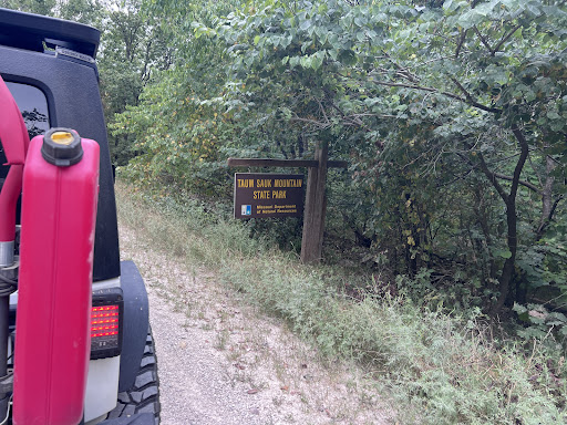
Taum Sauk Mountain
Arcadia Township, MO 63650
4.6(56)
Save
spot
spot
Ratings & Description
Info
Taum Sauk Mountain in the Saint Francois Mountains is the highest natural point in the U.S. state of Missouri at 1,772 feet. The topography of Taum Sauk is that of an elongated ridge with a NNW-SSE orientation rather than a peak.
Outdoor
Adventure
Scenic
Family friendly
Pet friendly
attractions: Taum Sauk Trail, Taum Sauk Mountain State Park, restaurants: , local businesses: St. Francois Mountains
Plan your stay

Pet-friendly Hotels in Missouri
Find a cozy hotel nearby and make it a full experience.

Affordable Hotels in Missouri
Find a cozy hotel nearby and make it a full experience.

The Coolest Hotels You Haven't Heard Of (Yet)
Find a cozy hotel nearby and make it a full experience.

Trending Stays Worth the Hype in Missouri
Find a cozy hotel nearby and make it a full experience.
Reviews
Live events

Sam & Hunter LIVE MUSIC
Sat, Jan 31 • 8:00 PM
The Brick & Barrel, 108 N Main St.,Ironton, Missouri, United States
View details
Nearby attractions of Taum Sauk Mountain
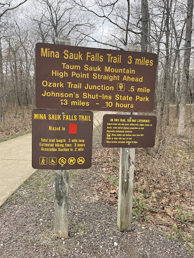
Taum Sauk Trail
Taum Sauk Mountain State Park

Taum Sauk Trail
4.7
(62)
Open 24 hours
Click for details

Taum Sauk Mountain State Park
4.7
(398)
Open 24 hours
Click for details
Nearby local services of Taum Sauk Mountain
St. Francois Mountains

St. Francois Mountains
5.0
(3)
Click for details