I did the walk, but not the final traverse of the north face, for which you need to hang on to a horizontal chain. I thought the benefit of getting onto the shoulder of the rock wasn't worth risking a fall. Others, perhaps less affected by fear, managed it without panic, though. The trail itself was good, but not always well marked. A companion refused to proceed at any junction until we found signs to confirm the route. This proved essential. I would have followed a wrong path were it not for her insistence. Against some advice I went south to north and I'm glad I did. In this direction you tackle the steep slopes going up, leaving the shallower northern track for your descent. The steep sections are effectively scrambles - you need to use your hands. There are always easy holds available in the rock and roots, though. There is little 'exposure' - if you fall you don't go far, but you could break a bone or twist an ankle. The trickiest stages are the stream crossings. It hadn't rained for four days when I did the hike and I wouldn't have gone if it had (the mud would be slippery and the streams deeper). I didn't count but there are about ten crossings. With careful balancing on stepping stones and lots of luck (all the stones were stable and grippy) I managed to keep my feet dry. All three of my companions got wet, though. I found it helpful to have a makeshift walking stick to aid my balance. If you are not fit you'll struggle and probably won't enjoy this walk. One companion, an overweight, 65-year-old smoker, got so out of breath he needed a three-minute rest for every three metres of ascent. Instead of taking 90 minutes to reach the top, it took us three hours. The whole excursion, from main road to main road, walking all the way and never rushing, took us seven hours. Others took much less. One athletic friend dashed from the waterfall in the south to the peak and back in two hours, he says. There are some real dangers but these can be mitigated if you're sensible. Tell someone you're going and when you expect to be back. Don't go on your own. Take sunscreen, a hat and at a litre of water. Take something to eat. Set out early in the morning. Don't go anywhere unless you see the route markers (blue plastic tape or orange metal triangles, fixed to trees). Wear shoes with good tread on the sole. Read the weather forecast and don't go unless it's going to be a fine day. The rewards are strolls through lovely glades, pretty waterfalls, big views from the top - from ocean to ocean across the island - and a great sense of...
Read more
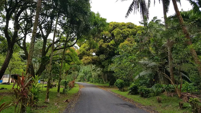
Set amongst the lush tropical landscape of Rarotonga, The Cross-Island Track is a rewarding and challenging hike in the Cook Islands. Winding through rainforests and stunning natural scenery, the 3-4-hour hike from the north to south coast is simply breathtaking. 
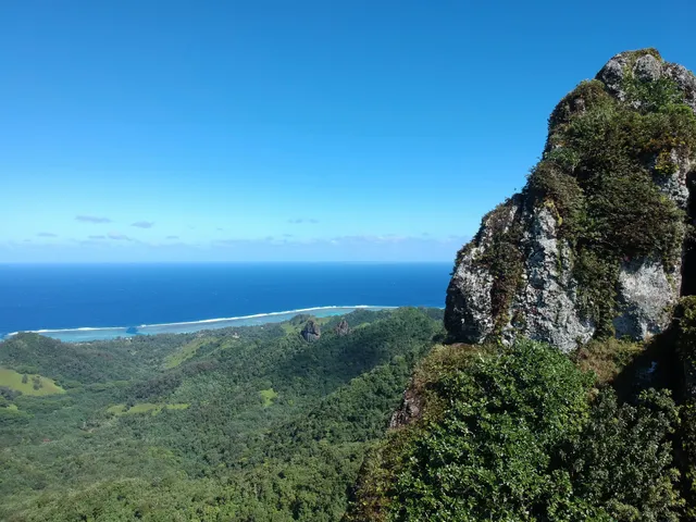
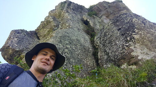
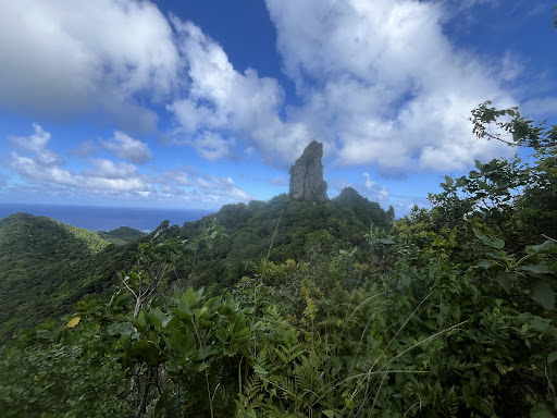
On your journey you can expect to see local wildlife such as chickens, goats, cows and birds. Prepare to be wowed by tangled tree roots, meandering steams, cascading waterfalls, spectacular rock formations and the iconic Te Rua Manga (The Needle). The Needle is a 413m high volcanic plug sitting in the very centre of the island. It is the highest rock formation on the trek and offers unbeatable views of Rarotonga. Although the descent to the top of The Needle is recommended for experienced climbers (at their own risk), the rest of the Cross-Island Track is suitable for hikers above the age of four with average fitness levels.
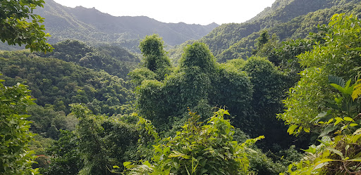
The hike begins at the edge of a thick dense forest where you will find steep inclines and stairs formed out of tree roots. Passing through cascading streams, follow the orange track markers to the plateau where you will get your first glimpse of The Needle. From here, continue along the path to find a series of ropes and chains to assist with the steep ascent to the base of The Needle, where you will find magnificent 360-degree views of Rarotonga. After this, hikers can choose to make their way back or hike the path to the south coast. This path is known to be slippery so take care when descending. You will complete the Cross-Island Track at the iconic Wigmore's Waterfall where you can join locals for a refreshing dip in the swimming hole.
It is recommended that hikers pack plenty of water, bathing suits, mosquito repellent and wear adequate shoes as some parts of the track can be quite slippery after rainfall. Although many hikers choose to do the track on their own. Several companies offer guided tours for Cross-Island Track Monday to Saturdays,...
Read moreThe wind howled through the jagged peaks as I clung to the icy rock face, my fingers numb, my breath coming in ragged gasps. The ground below was nothing but a blur of white abyss, a drop so far that survival wasn’t even a question—it was a certainty of death. My footing slipped, sending a spray of ice tumbling into the void, and for a split second, I felt the terrifying weightlessness of falling. Adrenaline surged through my veins as I lunged for a desperate grip, my body screaming in exhaustion, the mountain itself seeming to reject my existence. The storm raged on, visibility dropping, my strength fading—but in that moment, as the abyss threatened to consume me, survival became instinct. One final pull, one last desperate push against the unforgiving stone, and somehow, against all odds, I found myself clinging to the ledge, heart pounding, lungs burning. I was alive—but the mountain had come dangerously close to...
Read more