


Neah-Kah-Nie Mountain Trail - North Trailhead
4.6
(54)
Neahkahnie Viewpoint
4.9
(887)

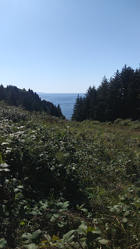
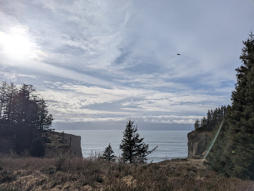
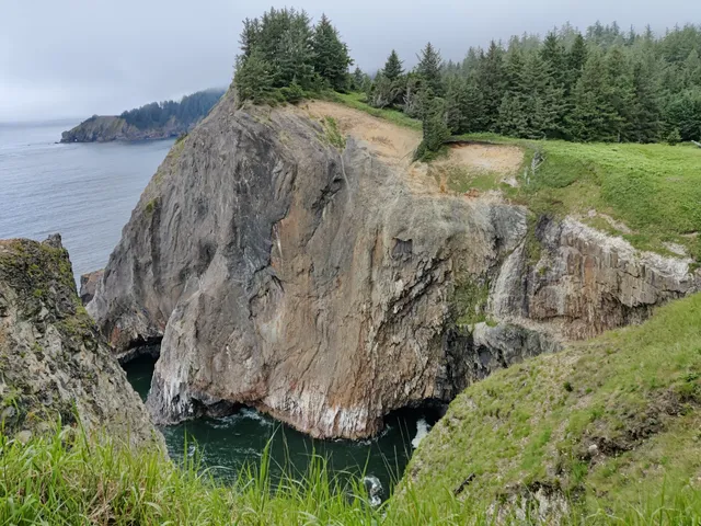
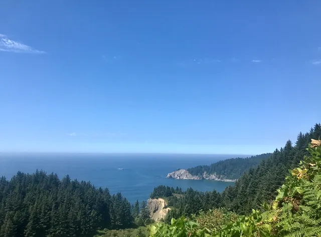
So after hitting Neahkahnie Mt. I decided to try the Elk Flats side. After walking down the start of the trail a short ways, which was steep and a bit rocky, we took the first turn to our left. It meander a bit through some thistles and other semi thorny plants. The view was nice and despite the terrain it was doable in flip flops. I soon found myself in a corridor or salal plants that was as a bit over 5' tall. I kept going down hill and soon found myself on a little narrow spit the had a great view plus a few places to sit. To my left was a rock out cropping that could of been on a castle. To my right were sheer rock cliffs and some sea caves you could peer into. But keep your kids or dogs close as it would be easy to lose your footing and fall into the ocean below. Once I got my fill my dogs and I headed back uphill as there were two more sets of trail to check out. But before we had made our way back to the main trail, we spotted a side trail again heading to my left and my dogs and I took it. It lead up to a rock out cropping but my dogs and I didnt see a way from where we were at to the top, so again headed for the main trail. Once there we stayed on it this time. As it headed into the woods. We were rewarded with a bench to sit on, solitude and great views. We weren't yet done. So we headed back the way we came, and took a left turn into the meadow. Thinking this lead someplace close, and with time to kill we went for it. About 20 minutes in it, dawned on me that this is part of the oregon coast trail, ( the sign up at the parking lots also said oregon coast trail ) so I figured let's just walk for a bit more and see where it takes us.. About what seemed like 30 minutes longer of rugged hiking we passed a bog and the dogs had a chance to get a drink. We continuing downhill and found a cool tree that you could walk thru or around and I realized this trail quite possibly goes all the way to the beach, which it did. Once we got to the beach, we came to a fresh water creek that gave the dogs another oppertunity to get a drink from. A bit of a rest for me, a great view, and then a killer hike back up. So three paths, all different views and settings as well as length of hikes. Easiest is stay to the main trail. Second is your first turn to your left. The hardest, stay on your main trail past the first turn to yohr left. Stay on the main trail til you can choose to go straight ir turn left. Head straight for a great short endurance hike and a nice...
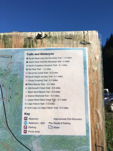
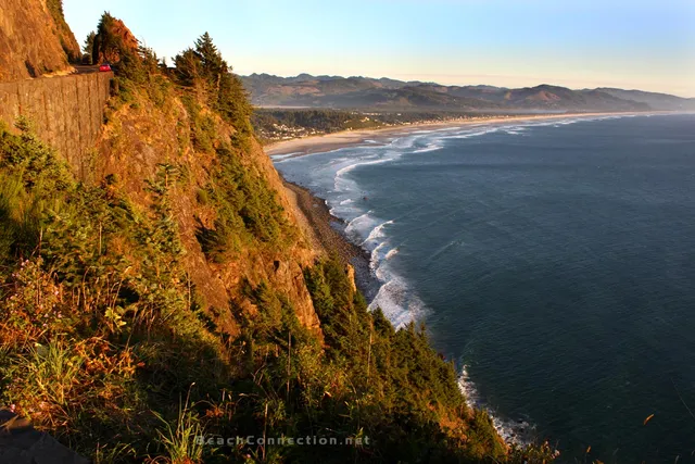
Read moreAfter reading all these other reviews.. I must have done this trail wrong!! I tackled this beast from the other direction (bouncy bridge). I do Not recommend to anyone who is not up for a vigorous workout or anyone who does not have appropriate foot ware. It is advised to have both hands free as well 🙂 It is extremely dangerous. Not only is it very steep, it is muddy and slick in spots. The only thing that was a life saver was the shade from the trees! I would have probably died if it was in strict sun! The most dangerous part is the trip hazards. The roots are very dangerous. We would have turned around but we knew it wasnt possible to go back Down this thing. We ended up veering off after about 1.5 hours to get to the highway. We couldnt see it, but could hear the cars. Then we had to walk the highway 3/4 mile back to our car! Was not a fun way to end our nice little hike down to the beach. We did drive to the “end” of the trail only to find out we were right there! It was beautiful and open and looked to have beautiful views, but we were already traumatized. I will not be doing the entire trail ever again. I would start from the beginning and do the open field area 🙂 If you do start down where the bouncy bridge is, PLEASE be careful! Not for amateurs. It would be really helpful for the trail signs to have the trail distances on them so you know what to expect. Especially when you don’t have cell...
Read moreWhat a gorgeous place! Due to damage from the recent windstorm, the full hike is only an out-and-back (don't expect to be picked up at the bottom, the footbridge across the river at the north end of the trail has been destroyed and the river is not safe to cross otherwise.) The most northern section of the trail (the last leg) is a steep, muddy, root-crossed set of switchbacks that take you down to South Beach and make this hike borderline Hard to complete. I marked it Moderate because the first half of the trail, including some of the best viewpoints, is easily navigable for hikers of any skill level. The total distance to hike all legs of the trail (both overlooks, then down to the beach, and back up to the parking lot) is 3.56 miles. Unfortunately, individuals with mobility issues should skip this location; the trail begins with a sharp gravel decline that would be unsafe for anyone with...
Read more