HTML SitemapExplore

La Malinche National Park — Attraction in Tlaxcala

Name
La Malinche National Park
Description
Nearby attractions
Nearby restaurants
Nearby local services
Matlalcueitl
90858 Tlaxcala, Mexico
Nearby hotels
Related posts
Keywords
La Malinche National Park tourism.La Malinche National Park hotels.La Malinche National Park bed and breakfast. flights to La Malinche National Park.La Malinche National Park attractions.La Malinche National Park restaurants.La Malinche National Park local services.La Malinche National Park travel.La Malinche National Park travel guide.La Malinche National Park travel blog.La Malinche National Park pictures.La Malinche National Park photos.La Malinche National Park travel tips.La Malinche National Park maps.La Malinche National Park things to do.
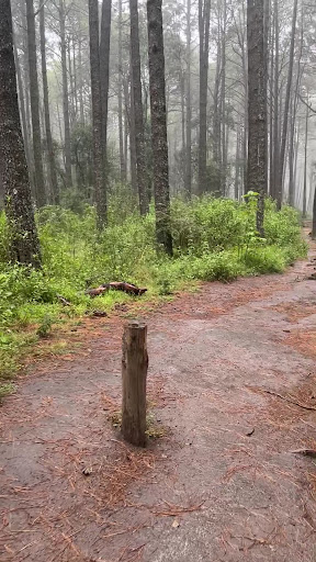
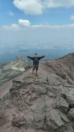
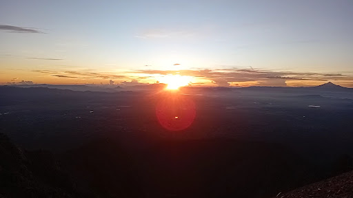
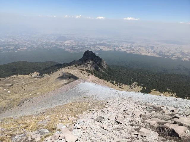
La Malinche National Park things to do, attractions, restaurants, events info and trip planning
La Malinche National Park
MexicoTlaxcalaLa Malinche National Park

Basic Info

La Malinche National Park

90510 Huamantla, Tlaxcala, Mexico
4.8(670)
Open until 11:00 PM
Save
spot

Ratings & Description

Info

attractions: , restaurants: , local businesses: Matlalcueitl
logoLearn more insights from Wanderboat AI.
Open hoursSee all hours
Tue7 AM - 11 PMOpen

Plan your stay

hotel
Pet-friendly Hotels in Tlaxcala
Find a cozy hotel nearby and make it a full experience.
hotel
Affordable Hotels in Tlaxcala
Find a cozy hotel nearby and make it a full experience.
hotel
The Coolest Hotels You Haven't Heard Of (Yet)
Find a cozy hotel nearby and make it a full experience.
hotel
Trending Stays Worth the Hype in Tlaxcala
Find a cozy hotel nearby and make it a full experience.

Reviews

Live events

Jazzland
Jazzland
Sat, Feb 14 • 8:00 PM
Av 22 Ote 1204, Barrio del Alto, 72000
View details
Asesino en la Ciudad Puebla: Juego Callejero
Sat, Feb 14 • 11:00 AM
Calle Constitución de 1917 3, Centro, Heroica Puebla de Zaragoza, 72000
View details
Candlelight: Tribute to José José
Sun, Feb 15 • 9:00 PM
Calle 3 Ote. 611, Centro histórico de Puebla, 72000 Puebla, Pue., 72000
View details

Nearby local services of La Malinche National Park

Matlalcueitl

Matlalcueitl

Matlalcueitl

4.8

(386)

Click for details
Get the Appoverlay
Get the AppOne tap to find yournext favorite spots!
Wanderboat LogoWanderboat

Your everyday Al companion for getaway ideas

CompanyAbout Us
InformationAI Trip PlannerSitemap
SocialXInstagramTiktokLinkedin
LegalTerms of ServicePrivacy Policy

Get the app

© 2025 Wanderboat. All rights reserved.

Posts

Simon LaimerSimon Laimer
Total Hike of 6-7 hour. Always easy to see the direction or the trail. Without registration you can enter to national park from 7am till 5pm. There are gates on the road and they open exactly at 7am. Start from Central Vacational - there is big parking log. The hike is moderate the first 2 hours - but then it starts getting steep - terrain is sandy which makes walking more tiring. When the view point after 2/3 of the trail is reached, the last 300 height meters are not that bad, even it is still super steep - but it is rocky and easy to hike. Start esrly, because rain comes in the afternoon. Bring 2-3 liters of water - depends what season you hike. I was there in September, a cloudy day, so 1 liter was enough. Bring good shoes for high mountain - best hiking shoes with good profile. Rain coat, sun protection, toilet paper and clothes for low temperatures are important to bring too.
Your browser does not support the video tag.
lupita valeriolupita valerio
Un lugar muy bonito si quieres convivir con la naturaleza, si falta señalización en las entradas pero un lugar muy bonito
Russ and Jaime SalonenRuss and Jaime Salonen
This hike and national park are true gems. We took an Uber from Puebla to the trailhead via the Huamantla Road from San Isidro Buensuceso. That road is in excellent condition. The owner of the little restaurant and store beside the resort was VERY helpful and friendly. The hike to the peak took me 3.5 hours. It's not technical but it is steep in a few places and the altitude forced me to take many short breaks. To return to Puebla we took the colectivo to Apizaco at 5pm sharp, and then caught a bus from there to the CAPU. Amazing experience, I would highly recommend to anyone who loves being in nature and to those who want the challenge of hiking a high elevation summit.
See more posts
See more posts
hotel
Find your stay

Pet-friendly Hotels in Tlaxcala

Find a cozy hotel nearby and make it a full experience.

Total Hike of 6-7 hour. Always easy to see the direction or the trail. Without registration you can enter to national park from 7am till 5pm. There are gates on the road and they open exactly at 7am. Start from Central Vacational - there is big parking log. The hike is moderate the first 2 hours - but then it starts getting steep - terrain is sandy which makes walking more tiring. When the view point after 2/3 of the trail is reached, the last 300 height meters are not that bad, even it is still super steep - but it is rocky and easy to hike. Start esrly, because rain comes in the afternoon. Bring 2-3 liters of water - depends what season you hike. I was there in September, a cloudy day, so 1 liter was enough. Bring good shoes for high mountain - best hiking shoes with good profile. Rain coat, sun protection, toilet paper and clothes for low temperatures are important to bring too.
Simon Laimer

Simon Laimer

hotel
Find your stay

Affordable Hotels in Tlaxcala

Find a cozy hotel nearby and make it a full experience.

Get the Appoverlay
Get the AppOne tap to find yournext favorite spots!
Un lugar muy bonito si quieres convivir con la naturaleza, si falta señalización en las entradas pero un lugar muy bonito
lupita valerio

lupita valerio

hotel
Find your stay

The Coolest Hotels You Haven't Heard Of (Yet)

Find a cozy hotel nearby and make it a full experience.

hotel
Find your stay

Trending Stays Worth the Hype in Tlaxcala

Find a cozy hotel nearby and make it a full experience.

This hike and national park are true gems. We took an Uber from Puebla to the trailhead via the Huamantla Road from San Isidro Buensuceso. That road is in excellent condition. The owner of the little restaurant and store beside the resort was VERY helpful and friendly. The hike to the peak took me 3.5 hours. It's not technical but it is steep in a few places and the altitude forced me to take many short breaks. To return to Puebla we took the colectivo to Apizaco at 5pm sharp, and then caught a bus from there to the CAPU. Amazing experience, I would highly recommend to anyone who loves being in nature and to those who want the challenge of hiking a high elevation summit.
Russ and Jaime Salonen

Russ and Jaime Salonen

See more posts
See more posts

Reviews of La Malinche National Park

4.8
(670)
avatar
5.0
2y

We did the hike today and it was beautiful. A few things to share

Getting to the trailhead from Puebla on public transport (if you don't want to Uber). First you need to get a bus from Puebla to Apizaco then collectivo from Apizaco to Malintzi resort where the trail starts. The collectivo only leaves at 8:20am and gets you to the trail head at 9:00am (40 mxn). We took an ATAH Ordinaro bus (66 mxn) from Puebla CAPU station to Apizaco and they said it takes 1.25 hrs (The Ejecutivo is only 1 hr but only leaves at 6:00 and 7:30am, not very helpful for connecting to the collectivo, costs 116 mxn). We took the 6:48 and got in at 8:05am to Apizaco and terminated only a block and half away from the collectivo point so we were in the collectivo with plenty of time. The collectivo leaves from the trail head at 5pm.

Definitely agree with others, going up the right side ridge after the tree line finishes and going the steep sandy route on the way back down

We didn't take a guide and were happy with the choice. There are plenty of people on the trail (did it on a Thu) and it's a pretty straightforward route (though still very tough, especially with the altitude). For the final bit after the ridge, the route is less clear but you just need to keep heading for the false summits until you see...

   Read more
avatar
5.0
7y

Un excelente lugar para estar en contacto con la naturaleza. El tiempo de ascenso a la cima desde el albergue puede variar dependiendo de la edad y condición física de cada persona. Para alguien con una vida sedentaria y en mala condición puede resultar imposible ascender hasta la mitad del bosque, mientras que para alguien en forma y joven no representa un reto tan grande. El tiempo de ascenso promedio es de cuatro horas por lo que se recomienda subir a mas tardar a las 12 de la tarde puesto que de hacerlo mas tarde se corre el riesgo de tener que cruzar el bosque de regreso en la oscuridad y en el frío. Es importante estar aclimatizado a la altura del lugar puesto que la cima se encuentra a poco más de 4,400m sobre el nivel del mar. No es indispensable tener equipo de montañismo para ascender el volcán pero si es necesario subir con ropa cómoda y abrigadora además de usar protector solar, tenis cómodos con suela con agarre y un par de bastones de senderismo o una vara pueden ayudar a ascender más cómodamente. El camino se divide en: El bosque: la primera mitad que va cruzando la vieja carretera es la parte más fácil pero la segunda mitad es más empinada y por lo mismo un poco más difícil. El sendero puede llegar a ser muy polvoso o lodoso dependiendo de la temporada. El arenal: Empieza donde termina el bosque, a partir de aqui el camino es de arena, al llegar a la cuesta la mejor forma de ascender al espinazo es por la parte de la derecha evitando las acumulaciones de arena que hacen gastar energía innecesaria. No hay un sendero tan marcado en este punto pero se recomienda subir hacia el espinazo que se aprecia desde este lugar. A partir de aquí las temperaturas bajan y el viento aumenta. El espinazo: En su primer parte el camino se encuentra marcado, el suelo es una combinación de arena y piedras, se recomienda descansar un poco en este punto y seguir el sendero, en la segunda mitad el sendero desaparece dando paso a una acumulación de lajas o piedras muy grandes, es necesario subir con cuidado evitando piedras movedisas puesto que podrían lastimar a alguna persona. Se recomienda ascender hacia donde se divisa la cima de esta parte. La cima: Después de las lajas se aprecia un sendero en un pequeño paso, al final del mismo se observa una acumulación rocosa que es la cima, es necesario caminar con cuidado y subir a la cima siempre teniendo tres puntos de contacto con las rocas/suelo. Las temperaturas pueden ser muy frías dependiendo de la temporada y es extremadamente importante usar protector puesto que la radiación solar es intensa a estas alturas. El regreso: Se hace por el mismo sendero solo que es altamente recomendable descender por la zona de las acumulaciones de arena para bajar más rápido y usando menos energía para luego incorporarse al sendero nuevamente. Que no te intimide la gente que sube con cascos, piolet, crampones y demás material profesional, ellos lo usan puesto que se encuentran entrenando para subir otros volcanes en los días posteriores. No olvides recoger toda tu basura, incluso la orgánica y si puedes lleva contigo un poco de la basura que encuentres en el camino. Por favor no pongas música con tus altavoces puesto que altera a la fauna del volcán y puede molestar a quienes vayan en busca de paz y...

   Read more
avatar
4.0
21w

Total Hike of 6-7 hour. Always easy to see the direction or the trail. Without registration you can enter to national park from 7am till 5pm. There are gates on the road and they open exactly at 7am. Start from Central Vacational - there is big parking log. The hike is moderate the first 2 hours - but then it starts getting steep - terrain is sandy which makes walking more tiring. When the view point after 2/3 of the trail is reached, the last 300 height meters are not that bad, even it is still super steep - but it is rocky and easy to hike. Start esrly, because rain comes in the afternoon. Bring 2-3 liters of water - depends what season you hike. I was there in September, a cloudy day, so 1 liter was enough. Bring good shoes for high mountain - best hiking shoes with good profile. Rain coat, sun protection, toilet paper and clothes for low temperatures are important...

   Read more
Page 1 of 7
Previous
Next