Our cruise ship is visiting Kotor, Montenegro very early so I awake well before sunrise and head to the top deck to view what is reported to be an amazing bay. I know from my research that the bay is 28km long and consists of four smaller broad bays united by narrower channels. When I arrive on deck we have entered the first bay - the bay of Herceg Novi. It is quite dark but the lights of the town are clearly visible ahead and also the outline of the mountains on either side. We then enter the largest bay – the bay of Tivat and it is still too dark to take photos. In the dim light you appear to have entered a Norwegian fjord but the balmy morning air tells you otherwise.
With improving light the scene is bright enough to photograph and is starting to become very special with high mountains framing the scene ahead and at both sides. Leaving the bay of Tivat you enter the narrow Verige Strait which is 2,300 m long and 340m wide and at this stage the light is almost perfect. Leaving the Strait you arrive at the most stunningly beautiful scene with the water on each side hemmed in by the overhanging cliffs of the mountains above. The bay of Risan is to the left, the Inner bay of Kotor to the right while ahead are the islets of St. George and Our Lady of the Rocks. These islets are beautiful in the early morning light and the church of Our Lady of the Rocks with its blue domes is a memorable sight. According to legend, the islet was made over the centuries by Croat local seamen who kept an ancient oath after finding the icon of Madonna and Child on the rock in the sea in 1452. Upon returning from each successful voyage, they laid a rock in the Bay. Over time, the islet gradually emerged from the sea.
The cruise ship passes the beautiful town of Perast, which hugs the shoreline underneath the mountain to the left, and drops anchor in the middle of the Inner bay of Kotor. The city of Kotor is hidden behind a headland but I seem to be able to make out the city walls which extend over four km into the mountains above. The sun is rising from behind the mountain to our left and gradually creeping over its crest. Its rays then hit the mountain to our right and the shadow on it moves ever so slowly down until eventually the water on the bay itself is shimmering in its light. Some ninety minutes after entering the inner bay and enjoying the spectacularly changing scene its time to break for breakfast.
After breakfast we take the tender into Kotor which docks close to the imposing city walls. A UNESCO World Heritage site, the old city was built between the 12th and 14th centuries and is filled with medieval architecture and historic monuments. The old city of Kotor today is considered to be the best preserved medieval urban area in the Mediterranean. There are three gates into Kotor and we enter through the Sea Gate which is the main gate into the city. We find ourselves in the Square of Arms – the main square and the most impressive in Kotor. The square is a bustle of activity and facing us as we enter is one of the symbols of Kotor - the Clock Tower. It was built in 1602 partly in Baroque and partly in Gothic Style. Below the Clock Tower there is the Pillar of Shame which was used for punishment of an accused person by placing them in front of the Pillar so that all the citizens of Kotor would know of their offence. We spent the next few hours in blissful abandonment enjoying the many squares, narrow streets, ancient palaces and churches. The most impressive church was the Cathedral of St. Tryphon built in 1166 where we viewed its priceless treasury.
We had planned to climb the city walls visiting the Church of Our Lady of Remedy on the way to the Fortress of St John at the top – a climb of 1200 metres. Having stopped for coffee and lunch and enjoyed a leisurely look at the old city and its magnificent buildings there just was not the time. Kotor is firmly on our bucket list to revisit and the city walls will then be the prime focus of...
Read more
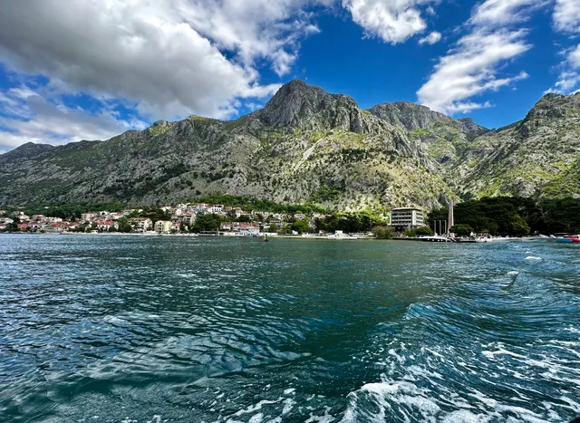
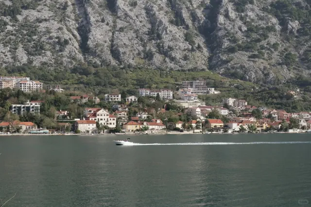
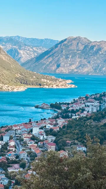
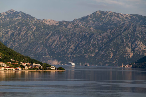
Бока-Которский залив представляет ушедший под воду в результате землетрясений речной каньон, проникающий вглубь материка. Залив площадью в 87 км² окружен кольцом высоких гор, защищающих его от открытого моря и холодных зимних ветров. С мая по октябрь длится летний туристический сезон. В этом средиземноморском оазисе растут апельсины и другие цитрусовые, гранаты, лавр, агавы, пальмы, эвкалипты, кипарис и мимоза. Бока-Которский залив (одна из самых красивых морских бухт в мире и крупнейшая в Адриатике) в 1979 году включен в Список всемирного культурного наследия ЮНЕСКО. «Бока» в переводе на русский язык — «рот, пасть». По-черногорски и по-сербски название залива произносят Бока Которска, а по-русски встречается несколько вариантов — Боко-Которский, Бока-Которский или Которский. Местных жителей часто называют «бокельцы», то есть «жители залива». Бока-Которскач является одной из лучших природных гаваней Европы и в свою очередь делится на четыре залива. Вход в Боку со стороны моря открывает залив Херцег-Нови, после прохождения пролива, справа расположен залив Тивата, далее узкий пролив Вериге, за которым справа расположен залив Котора (отделенный от залива Тивата горным полуостровом Врмац), слева — залив Рисана. На акватории Боки имеется семь островов, среди них наиболее посещаемые туристами и паломниками — Мадонна на Рифе» («Божья Матерь на Скале») и Госпа од Мило (Милосердная Богоматерь). Территория вокруг Которского залива была заселена ещё в античную эпоху. Здесь существовали иллирийские, греческие, римские поселения, однако наибольший след оставили славянские народы — хорваты, сербы и черногорцы. Средневековые города Котор, Пераст и Херцег-Нови сохранили венецианский блеск. На берегах и островах залива сохранились старинные православные и католические храмы, некоторые из них являются местами паломничества. Самое первое поселение на берегах Которского залива возникло на месте современного Рисана. Иллирийский Ризон упоминается в 229 году до н. э., а в 168 году до н. э. был захвачен Римом. Тогда же впервые упомянут Аскривиум, нынешний Котор, ставший центром Боки. При византийском императоре Юстиниане I в 535 году выше города была воздвигнута крепость. С раннего средневековья город стал значимым далматинским городом-государством под итальянским названием Каттаро. В 1002 году он был оккупирован Первым Болгарским Царством, но годом позже уступлен Сербии. При сербском владычестве в качестве полунезависимой республики продолжил специализацию на морской торговле. После падения Сербии в 1389 году город с прилегающими землями был захвачен сначала Боснийским королевством, затем Венгерским королевством, а в 1420 году попал под власть Венецианской республики. В 1538 и 1657 годах Каттаро осаждался османами, сильно пострадал при землетрясениях 1563 и 1667 годов. Обладая мощным флотом в 300 кораблей (18 век), Бока Которска являлась серьёзным соперником...
Read moreThe most beautiful city in Montenegro. Incredible landscapes of the Bay of Kotor and the amazing Old Town! I recommend coming to this city for an excursion, if possible on your own, as here you will not be able to see everything in 2 hours! This place is worth spending the whole day! There are paid parking lots where you can park your car, the cost per 1 hour is from 1€ to 2€. To see the Bay of Kotor - rent a boat 40€-45€ for 1 hour. There are a lot of cafes on the territory of the Old Town, if you plan to have lunch - the average check for 2...
Read more