Nice hikes and good scrambling from the rim to the top.
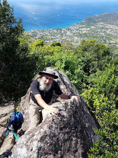
I did all trails (except Mazinga) on the mountain in one day. I have a fairly good condition, like going on hiking holidays but not running marathons.
I started 20 minutes after sunrise. That was nice for the temperature, but almost all routes are shaded and being higher takes 3 degrees of. So in afternoon would be fine too. Best reason to go early is that then there are less clouds to obstruct the view.
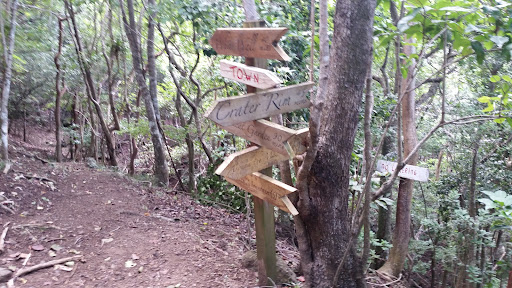
All the signs for all the routes are good enough to very very good. On the panorama route and the around the mountain route I lost my way often for about 20 meters and then the helpful coloured ribbons would get me on my way again. Cell cover is reasonable on the north slope, otherwise very limited.
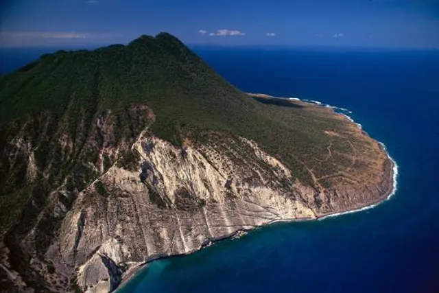
From the base of the mountain to the rim was half aan hour, first part stroll in the park, last part bit steeper, but good path. Suitable for people with fear of heights.
Next I did the panorama trail. Indeed it has many places with beautiful views. On the map it ends at a small peak that has s signalling light on it. If you enjoy scrambling you can continue to go to the top. The route is marked with ribbons. When wearing shorts expect scratches on your legs. It gets progressively more demanding and exposed, until alpine climbing grade II. Fear of heights is a handicap here. But you can always turn around. I turned around a few meters below the top: a was afraid of making the climbing moves. Too bad, a small ladder or via ferrata style iron bars would have gotten me through. And then I could have rounded the rim by descending over the Mazinga trail. I went back the way I came. Took me 3 hours in total from start at the rim, including breaks.
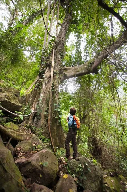
The trail down the crater is fun, natural beauty, fun things for kids like s swing in a giant tree. You should not have fear of using your hands a bit when hiking. There are some steep parts, but no big drops, so fine if you have normal appreciation of heights.
All the rocks are covered in mosses though. They turn into a soapy substance when wet. So not recommended when wet, hiking boots won't help. I took 1 hour 15 including break.
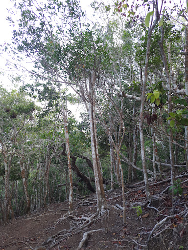
Then I did the around the mountain trail, clockwise. That has the advantage that you start with the harder Northern part first. That part you have to climb over some fallen trees and have to push through the plants at some points. Otherwise the path is good. It's nice in the sense that it is less steep and more even, more time to contemplate anything else then your feet. Vegetation in the north is rain forest, that changes to Mediterranean style on the south. In the south nice views of Saba. I...
Read more