We love the Pilanesberg National Park and have been visiting regularly for over 30-years. It’s a 2 ½ hour gentle drive from Sandton. I’d strongly recommend the N4 route from the Hartbeespoort Dam via Rustenburg. This routing is around 10km longer than the alternate route via the villages. It’s a far safer route as it avoids the many vicious unmarked speed humps, 4-way stops and animals on the road.
GENERAL COMMENTS AND GUIDANCE Note to overseas visitors in particular, the park is NOT a zoo. So, if you are doing a self-drive tour and are not staying in one of the various lodges which have well-trained rangers who will drive you in specially equipped vehicles and who are in radio contact with each other, then you may see masses of game, or very little, on any particular drive. The challenge with the organised drives is that there will typically be many vehicles competing to see any particular sighting, particularly cats. I find this bunfight particularly frustrating and prefer to take my chances on a self-drive experience, preferably in a 4 x 4 or SUV vehicle with a decent passenger height above ground. Small salon cars, though used by many people are not advised. They are uncomfortable on the graded roads throughout the park and viewing is very limited due to passenger height above ground.
The roads in the Pilanesberg National Park are mainly sand roads, these are typically well graded and easy to navigate. However, some roads may have very rough, rocky, uneven patches, particularly after heavy rain and overuse during peak season. This is another good reason for choosing an appropriate vehicle for the trip, alternatively taking an organised drive with a game ranger. There are two main tar roads dissecting the park and intersecting at the Mankwe dam. Years ago, these roads were very well maintained but they have been allowed to become extremely broken up with many potholes and large sections of tar missing at the edges. Many visitors openly state that it would be better for all users if the tarmac was removed, and the roads graded as these two roads are beyond economical repair. I fully agree with this sentiment. Tip: Purchase a map of the park at the entrance or from one of the resort lodges. The road intersections are well signed with road names, distances and landmarks in each direction. It’s difficult to get lost in the park so don’t be afraid to self-drive.
The are many places to stay within the park to suit any budget, we've stayed at most of them, over the years. They range from inexpensive camp sites and chalets to up-market fully catered luxury lodges that, in my opinion, meet all expected international standards. Tip: Check speciality booking websites such as Bushbreaks as well as the resorts’ own web sites, in addition to review websites. There are often good deals to be had during school term times, away from public holidays and particularly during the week rather than at weekends.
The Pilanesberg Centre. This is a well-priced budget café/restaurant facility in the very heart of the park. It has been recently upgraded and has generator power. We have been very pleased with the standard of food and service. Also, the coffee is excellent. There is a gift shop and a minimarket that sells beer, spirits, cool drinks and snacks. There is a viewing deck, and many animals come to graze & drink.
ANIMALS & BIRDS: The park has an amazing variety of species and offers the big five (Lion, Elephant, Rhino, Buffalo and leopard) as well as a host of grazing animals. There also several cheetah families, though sightings are far rarer. Importantly, there are over 300 species of birds in and around the Pilanesberg, so it’s a birders paradise Tip: Take a good pair of binoculars. Also, take a decent camara with a telephoto zoom lens, not just a mobile phone. Rather than discussing the animals I’ve included just a few of the many photos I’ve taken during our recent stays in the park. No birds as I have simply too many to choose from. I’ve included a hastily grabbed shot of a honey badger as these are...
Read morePilanesberg National Park, located in South Africa’s North West Province near Sun City, is a geological and ecological marvel — and its map vividly showcases this uniqueness. Situated within the eroded remains of an ancient volcanic crater, the park’s circular layout is unlike any other reserve in the country, and this unusual topography is immediately noticeable when studying the map.
Covering approximately 550 square kilometers, the map outlines a relatively compact but richly diverse park. Its circular boundary, formed by concentric rings of hills that once made up a volcanic crater, is marked with shaded relief and elevation contours, helping to illustrate the dramatic ridges and valleys that define the landscape. This natural amphitheater is not only visually striking but also contributes to the park’s incredible biodiversity.
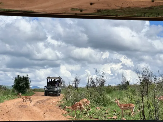
The road network is extensive and clearly labeled, forming a web of tarred and gravel loops that make the park highly accessible for self-drive safaris. The primary routes such as Kgabo Drive, Kubu Drive, and Tshwene Drive are highlighted, with secondary roads leading to more secluded areas. The roads converge around central points of interest, making navigation intuitive. What sets Pilanesberg apart, and is well illustrated on the map, is how accessible major game-viewing areas are — most of the park can be explored within a single day, making it ideal for short trips.
One of the most prominent features on the map is Mankwe Dam, located at the heart of the park. This large body of water is a key focal point for wildlife and birdwatching, and it’s surrounded by several hides and viewpoints like Fish Eagle Picnic Spot and Mankwe Hide, all marked with icons. These are essential stops for any visitor, offering shaded areas, restrooms, and a chance to quietly observe wildlife.
The map also highlights multiple entrance gates — including Bakubung, Manyane, and Kwa Maritane — each linking to various lodges and camps. These access points are well connected to nearby towns and to Sun City, which lies just outside the southeastern boundary of the park. Accommodation icons and labels for resorts, campsites, and luxury lodges help users understand where each option is in relation to the park’s routes.
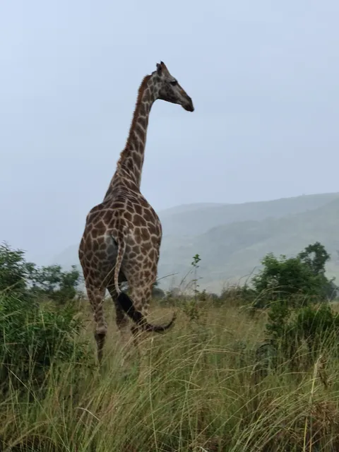
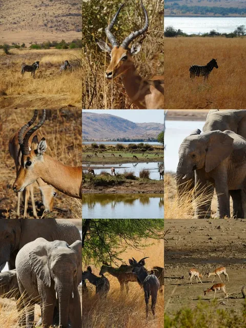
Pilanesberg is home to the Big Five, and the map’s layout allows visitors to efficiently plan game drives around waterholes and open plains where sightings of lions, elephants, and rhinos are common. Waterholes such as Tshukudu, Rathlogo, and Malatse are clearly marked and offer excellent opportunities for wildlife photography, especially during the dry season.
Vegetation zones and terrain types are subtly shaded to reflect the varying habitats—from rocky outcrops and thickets in the west to grassy plains and savannah in the east. This natural variation supports over 7,000 animals and more than 300 bird species. The map helps users visualize this variety and plan routes based on their wildlife interests, whether they're birders, big game seekers, or landscape photographers.
In conclusion, the map of Pilanesberg National Park is not just practical; it’s an essential companion that visually captures the park’s rare geological structure and rich biodiversity. It balances topographical detail, route planning, and wildlife viewing strategy, making it one of the most user-friendly and immersive park maps in South Africa. Whether you're a first-time visitor or a returning explorer, this map is your key to unlocking the circular wilderness of...
Read morePilanesberg National Park, a notable and appealing national park in South Africa, is located in the North West Province, close to the Sun City resort. It is South Africa's fourth biggest national park, spanning over 55,000 hectares. Its distinctive geographical features, great biodiversity, and ease of access have made it a popular tourist destination. The following details provide a deeper insight into this wonderful park:
Pilanesberg is located around 170 kilometers northwest of Johannesburg and near to Sun City. Driving from Johannesburg normally takes two to three hours. Alternatively, guests can take guided trips departing from Johannesburg and Pretoria.
Pilanesberg is located in the crater of an extinct ancient volcano. This peculiar geological feature has created a breathtaking scene. Circular hills and wide plains provide spectacular panoramic vistas.
Because of its unique geographical location, Pilanesberg acts as a confluence point for multiple habitats, resulting in exceptional biodiversity. The park is home to Africa's "Big Five": lions, leopards, elephants, rhinoceros, and buffalo. Other animals in the park include giraffe, zebra, impala, kudu, brown hyena, African wild dog, and a variety of birds.
Pilanesberg has a notable benefit over several other South African national parks in that it is free of malaria-carrying mosquitoes, which reduces tourists' health worries.
During a safari in the park, a radio message alerted us to a cheetah hunting a baboon. When I arrived at the scene, I was astounded to see the cheetah carrying such a heavy baboon up the tree. The event was deeply unforgettable, even if the cheetah was not spotted.
This trip also revealed that, despite their deceptively gentle look, hippopotamuses are among the most hazardous animals in the African environment.
The African elephants witnessed were noticeably bigger and more intimidating than their Asian counterparts, accentuating the splendor of...
Read more