IMPORTANT INFORMATION
Read this before you walk this route, otherwise you might pay a lot for a taxi to reach your car / your starting point!
Tuesday July 22nd 2025 we hiked from Poncebos to Caín = 12 kilometers / 7.46 miles (one way).
🅿️🌄 We arrived at the starting point in Poncebos an hour after sunrise (7:50). 10 cars were already parked along the road, but for the most part we were alone on the route.
⌚🥾 The steep part from Poncebos took me 1 hour, after that the hike is mainly flat until the end near Caín where you will meet a few smaller ups and downs.
It took me 4:25 hours in total to walk the 12 km. A lot of people passed me from behind walking faster than me. I am 50 years old, work at a computer and don't exercise much. I'm a slow walker who likes to enjoy the view and I have some problems with my knees. My 17 year old son did the hike twice (Poncebos to Caín, then half way back to Poncebos, and back to Caín) before I finished.
🪨🪨🥾 Several parts of the track has loos stones on the path, so I recommend hiking boots.
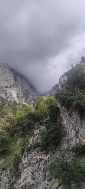
☀️☁️ The route varies between shade and sun. Bring a cap and sunscreen for the sunny parts. Near Caín it was about midday and it became quite hot on the walk.
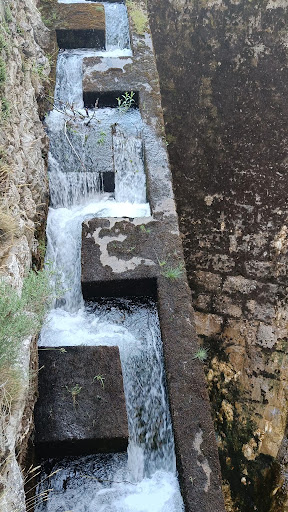
🍶💧 I drank 2.5 liters while walking the 12 km. You can fill your water bottle in natural springs 1:30 after Poncebos and near Caín. We saw no springs in the middle of the route, though water was dripping down the sides of the mountains at several locations, so I imagine these are actual springs in the colder part of the year. We did the hike in July.
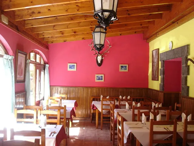
🍽️ Both in Poncebos and Caín you will find restaurants (with toilets 🚽👍🏼) at the end of the route.
🧻🗑️ Apart from a few corners, here is no privacy during the route. Bring your own toilet paper and some waste bags for used toilet paper. At some locations we saw left behind toilet paper - be mindful and take your trash with you. You will find a big waste container at the end of the route.
🚏🚍 We planned take the public bus back to our car in Poncebos. But the bus between Caín and Poncebos only runs from Friday to Monday. See the pictures of the bus schedule.
So if you want to do the hike in the not so crowded weekdays you need to arrange another kind of transportation back to your starting point.
🚙 We saw adventure company Jeeps picking up people, so I assume you can buy a full package tour with a pick-up at the end.
🚕 The price for a taxi between Poncebos and Caín is € 170 (one way) and take 2:30 hours. So it is almost as fast to walk back.
A taxi ended up being our solution since my knees weren't fit for another 12 km back to Poncebos - though the rest of the family was fit for another 12 kilometers.
🍀Lucky for us the Taxi driver filled the taxi to its maximum 7 people, which reduced the price to “only” 97 euros for the four of us in total 💸
🗓️ We recommend booking the taxi in advance (see picture with phone numbers). When arriving at Caín I called several taxi drivers and all of them were 2-4 hours away. Finally I reached Sandra who was only 30 minutes away. She only speaks Spanish and a little English. The staff at the tourist information at Caín (located where the route ends) was very helpful, speaking with her on the phone and arranging everything .
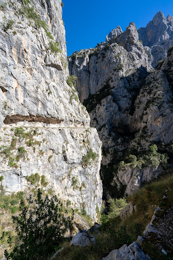
⭐ Our recommendation ⭐ If we had known what we know today we would drive to Caín and only walk half the route in and return back to Caín. We think the route is most beautiful from the Caín side, this is where you'll meet the dam, the natural holes in the cliffs, the tunnels, the part of the route with the cliff hanging over the path, and the best views to the river below.
⭐⭐⭐⭐⭐We rate Routa Del Canes 5 stars. It is just as beautiful as Camino Del Rey if not more beautiful because it is more green (we did Camino Del Ray in October).
However the hike between the two peaks Pico do Areeiro and Pico Ruivo at Madeira island is still the most spectacular hike we have done.
I wish you a delightful hike and hope that my information will help you plan your...
Read more