Wufenshan Trail things to do, attractions, restaurants, events info and trip planning

Basic Info
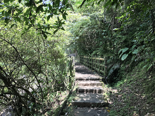
Wufenshan Trail
226, Taiwan, New Taipei City, Pingxi District, 頂寮子5號
4.4(311)
Open until 12:00 AM
Save
spot
spot
Ratings & Description
Info
Outdoor
Adventure
Scenic
Family friendly
Pet friendly
Off the beaten path
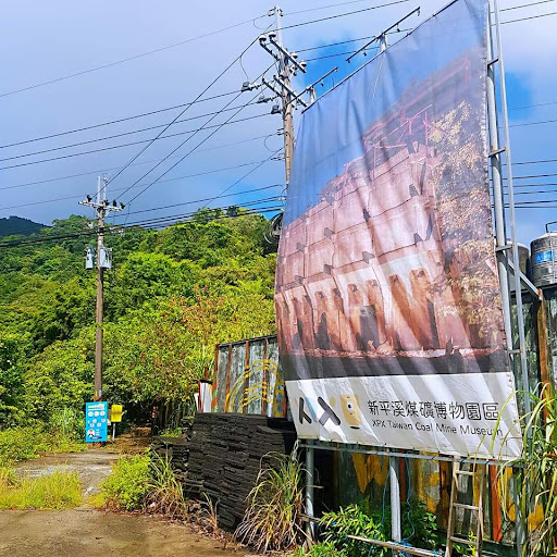
attractions: Taiwan Coal Mine Museum, restaurants: , local businesses:
Phone
+886 2 2495 8680
Open hoursSee all hours
ThuOpen 24 hoursOpen
Plan your stay

Pet-friendly Hotels in New Taipei
Find a cozy hotel nearby and make it a full experience.

Affordable Hotels in New Taipei
Find a cozy hotel nearby and make it a full experience.

The Coolest Hotels You Haven't Heard Of (Yet)
Find a cozy hotel nearby and make it a full experience.

Trending Stays Worth the Hype in New Taipei
Find a cozy hotel nearby and make it a full experience.
Reviews
Live events

Yoga Open House | 瑜珈開箱聚會
Thu, Feb 26 • 11:00 AM
Songshan District, Taipei City
View details

#038 HYROX Taipei Shake Out Run
Thu, Feb 26 • 11:30 AM
So Tipsy, 110, Taiwan, Taipei City, Xinyi District, Songren Rd, 38號一樓
View details

hololive STAGE World Tour 25 -Synchronize!- @ Taipei 後夜祭 After Party
Fri, Feb 27 • 1:30 PM
Da’an District, Taipei City
View details
Nearby attractions of Wufenshan Trail
Taiwan Coal Mine Museum
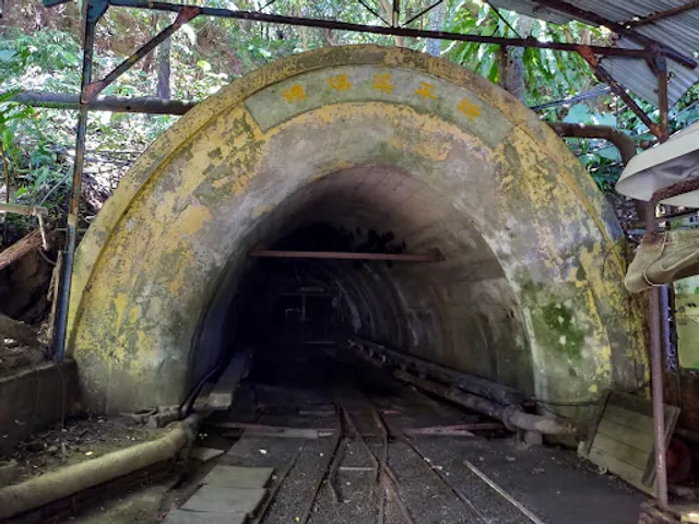
Taiwan Coal Mine Museum
4.3
(690)
Open until 5:00 PM
Click for details