Shuishe Great Mountain Nature Trail things to do, attractions, restaurants, events info and trip planning

Basic Info
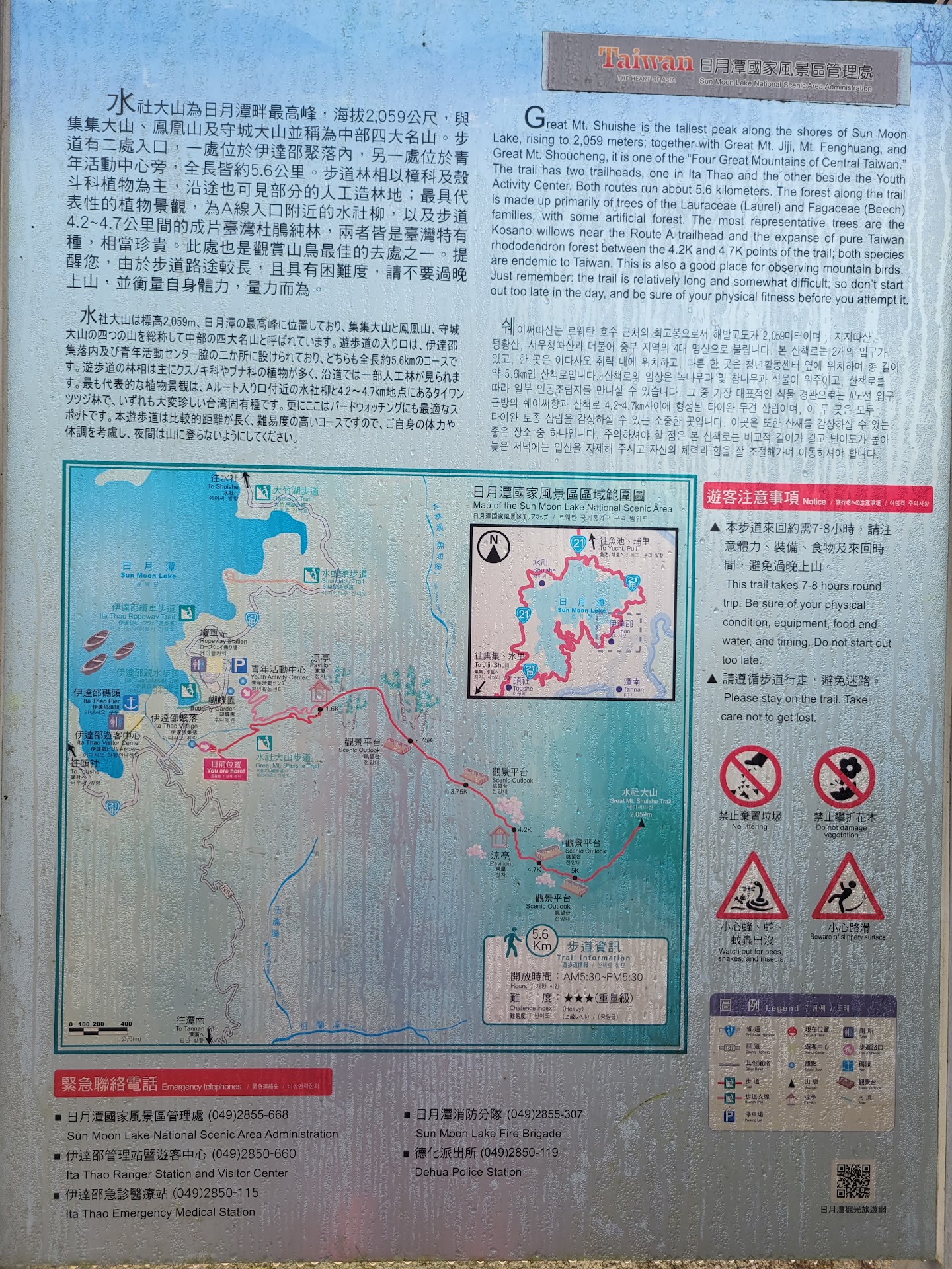
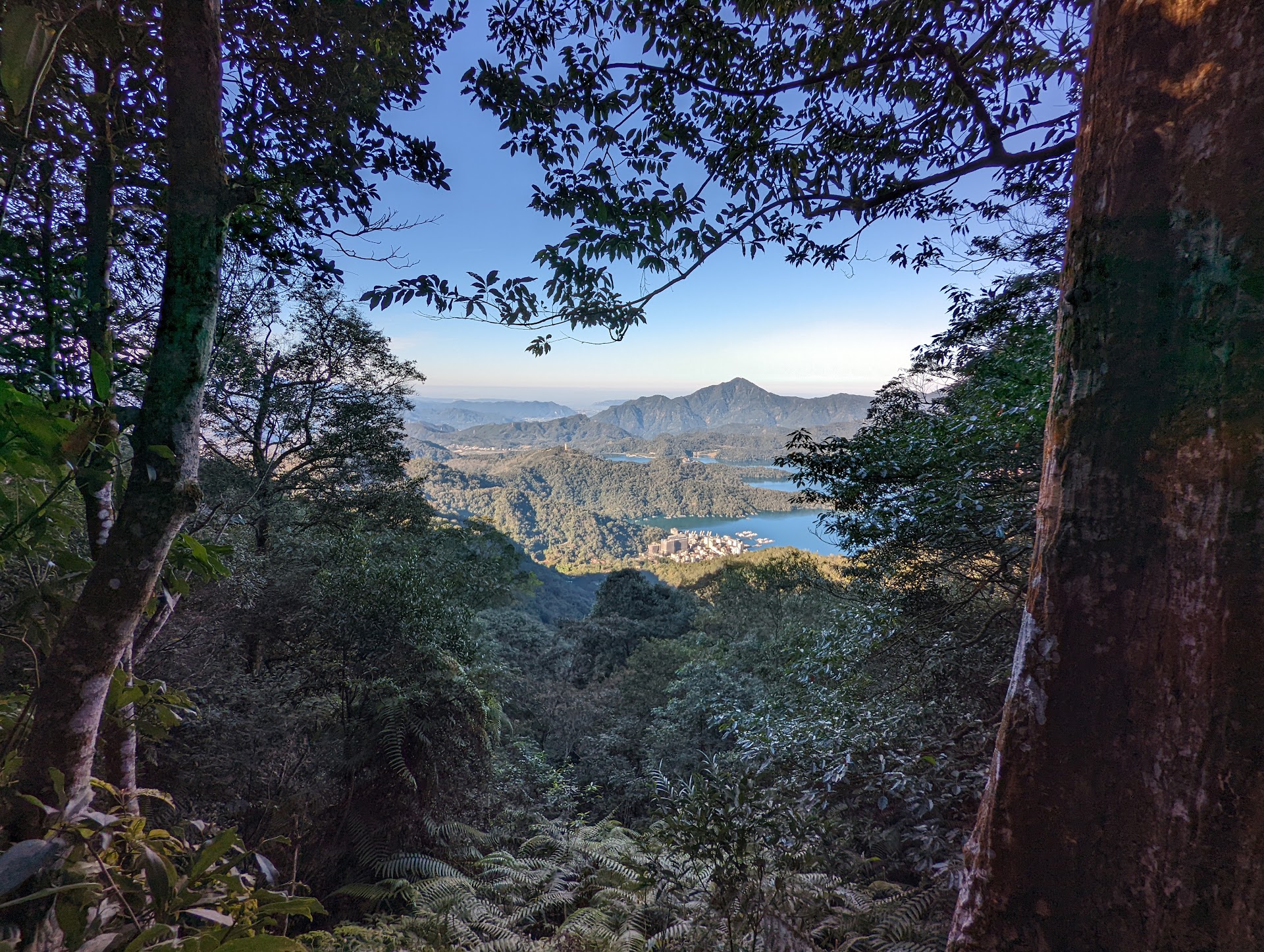
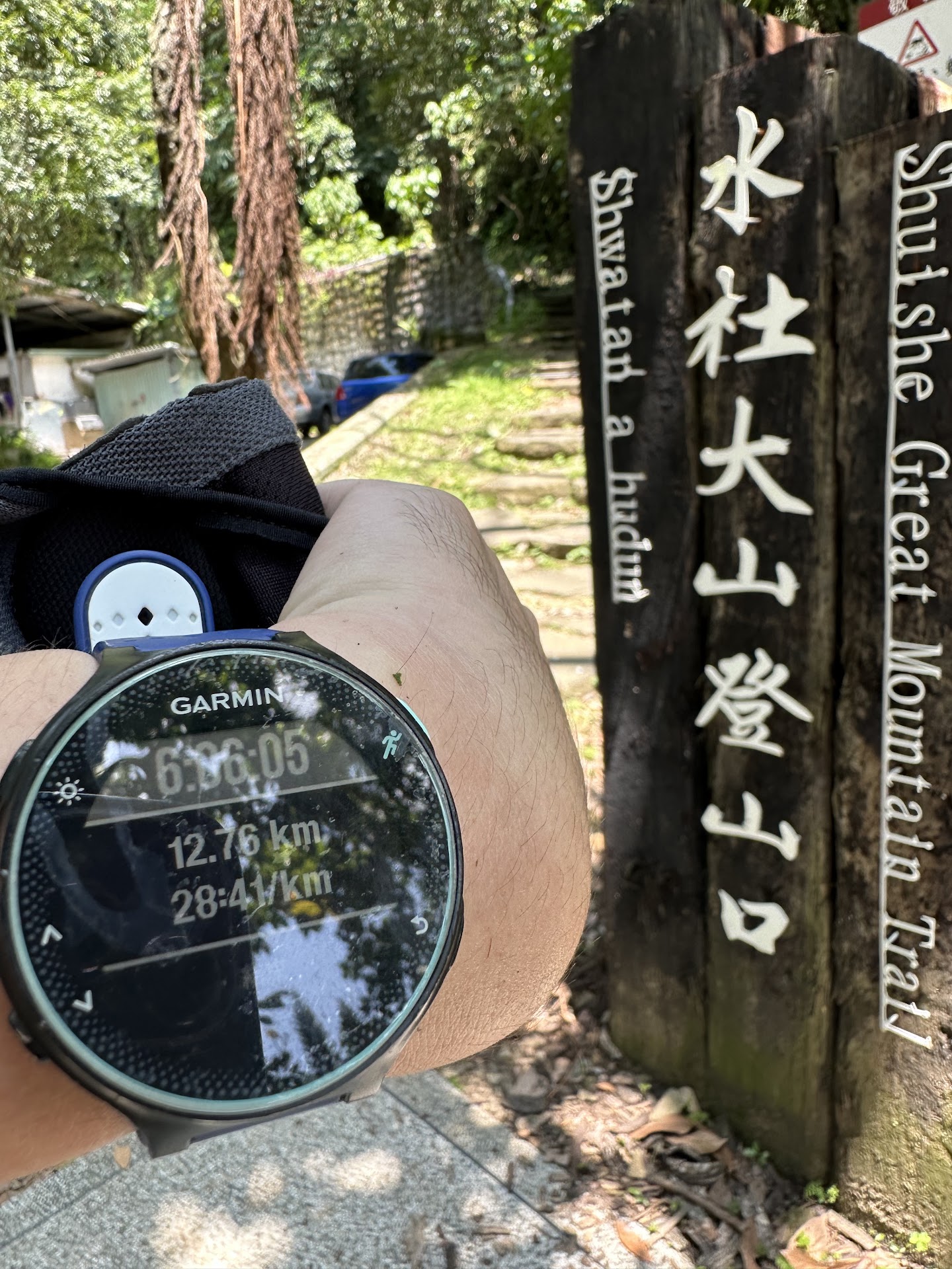
Shuishe Great Mountain Nature Trail
555, Taiwan, Nantou County, Yuchi Township
4.3(208)
Open 24 hours
Save
spot
spot
Ratings & Description
Info
Outdoor
Adventure
Scenic
Family friendly
Off the beaten path
attractions: , restaurants: , local businesses:
Website
hiking.biji.co
Plan your stay

Pet-friendly Hotels in Yuchi Township
Find a cozy hotel nearby and make it a full experience.

Affordable Hotels in Yuchi Township
Find a cozy hotel nearby and make it a full experience.

The Coolest Hotels You Haven't Heard Of (Yet)
Find a cozy hotel nearby and make it a full experience.

Trending Stays Worth the Hype in Yuchi Township
Find a cozy hotel nearby and make it a full experience.