Ledges State Park things to do, attractions, restaurants, events info and trip planning
Basic Info
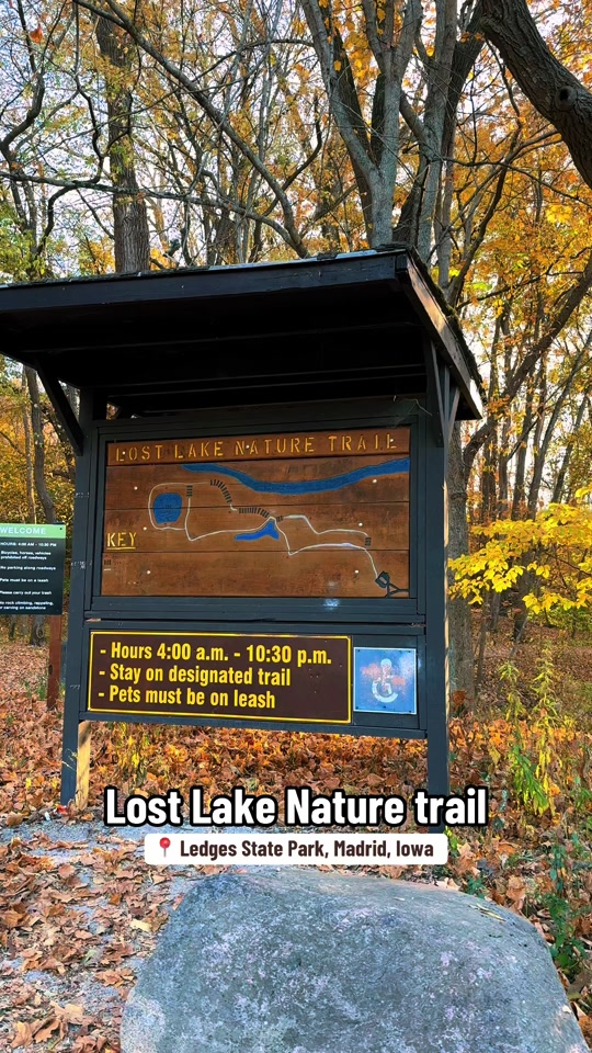
Ledges State Park
1515 P Ave, Madrid, IA 50156
4.8(1.4K)
Open until 10:30 PM
Save
spot
spot
Ratings & Description
Info
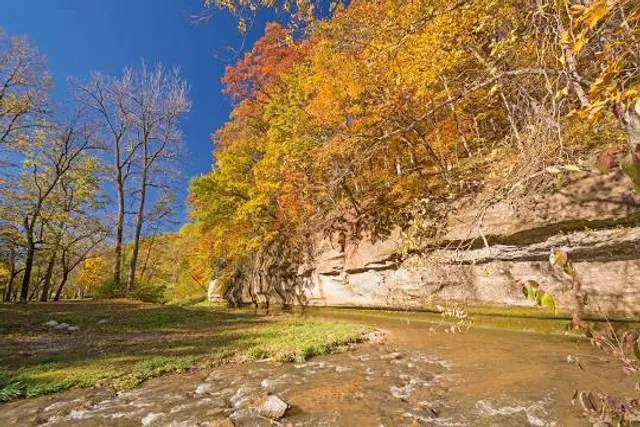
Ledges State Park is a state park of Iowa, USA, located approximately four miles south of the city of Boone. The park contains a sandstone gorge carved by Pea's Creek, a tributary of the Des Moines River. The gorge is 100 feet deep in places, with concretions jutting from the cliffs.
Outdoor
Adventure
Family friendly
attractions: , restaurants: , local businesses:
Phone
(515) 432-1852
Website
iowadnr.gov
Open hoursSee all hours
Fri4 AM - 10:30 PMOpen
Plan your stay

Pet-friendly Hotels in Boone
Find a cozy hotel nearby and make it a full experience.

Affordable Hotels in Boone
Find a cozy hotel nearby and make it a full experience.

The Coolest Hotels You Haven't Heard Of (Yet)
Find a cozy hotel nearby and make it a full experience.

Trending Stays Worth the Hype in Boone
Find a cozy hotel nearby and make it a full experience.
Reviews
Live events

2026 RTI Stock/Hobby/Street Stock Car Chassis School
Fri, Feb 20 • 8:30 AM
BHE - Bob Harris Enterprises, Crossfit West Ames, 2316 230th St, Ames, IA 50014, United States
View details

62nd Mid-Iowa Coin-A-Rama
Fri, Feb 20 • 2:00 PM
Quality Inn & Suites Starlite Village Conference Center (2601 East 13th Street, Ames, IA), United States
View details

Groovy Family Dance Party at Hope Ames
Fri, Feb 20 • 6:00 PM
The Link, 3329 Lincoln Way, Ames, IA 50014-7528, United States
View details