San Angelo State Park tourism.San Angelo State Park hotels.San Angelo State Park bed and breakfast. flights to San Angelo State Park.San Angelo State Park attractions.San Angelo State Park restaurants.San Angelo State Park travel.San Angelo State Park travel guide.San Angelo State Park travel blog.San Angelo State Park pictures.San Angelo State Park photos.San Angelo State Park travel tips.San Angelo State Park maps.San Angelo State Park things to do.
Dallas | A Collection of Lotus Viewing Spots Nearby
Zoé Dubois
442
It’s not a destination vacation, but if you find yourself stuck in the area, it’s one of the best things to do if you’re trying to stay out of trouble.
The water level in the reservoir is low, but there’s still one boat ramp accessible, and that’s the one nearest the dam.
Other things to do here:
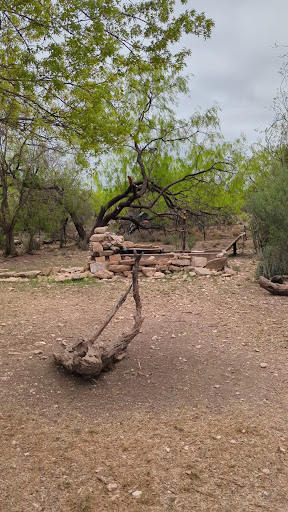
Tent camping, RV spots with electricity and water, or you can rent a cabin.
And, oh yeah, there’s always the option of hiking alongside the “Official State of Texas Longhorn Herd!” (more on that later)
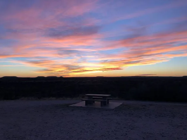
Hiking: You can spend a few days out here and still not get to every trail. I managed to hit about 70% of them over several days.
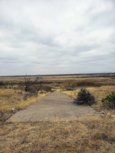
It’s west Texas, so don’t expect a whole lot of elevation change, but the cool thing is there’s hardly anyone on these trails! The park is so huge, that there are *separate trail maps* for the northern and southern section, so make sure you grab one of each before you begin your journey.
Favorite trails:
Roller Coaster Trail (the most elevation change (only about 70 feet over the course of half a mile) and a couple of good views of the open plains)
Playground Trail (probably the best for mountain biking, but can also be confusing and hard to find your way out toward the end)
Flintstone Village Trail
North and South Slick Rock Trails- nice ups and downs - also good for mountain bikers.
Least favorite trails:
Badlands Trail - pretty flat, and TONS of side trails created by mountain bikers, so it’s very easy to get lost here.
Roadrunner Trail/Strawberry Trail - VERY flat, boring, and easy.
Longhorn spotting:
Trailhead to Trailhead Route (look for the water trough just south of where Flintstone Village Trail intersects with the Trailhead to Trailhead Route)
Here’s where I encountered the most longhorn. It was on the Badlands Trail and parts of the River Bend Trail. They’re docile for the most part, but don’t be surprised if you turn a corner and encounter one that doesn’t want to move off of the trail. I had one that snorted/grunted at me and that told me it was time to back out and take a different trail!
I like the trails in the northern part more than the southern part. They’re just more fun. Although Roller Coaster Trail in the southern part was fun and had some good views, so it’s worth a spin.
Kudos to the person who came up with the fun trail names like Badlands, Roller Coaster Trail, Playground Trail, Flintstone Trail, Lanky Lackey, Winding Snake, Cougar Overlook and Lower Ghost Camp Trail. I guess that person was on vacation when they decided to name the Trailhead to Trailhead Route. What the hell does that even mean???
#KeepTexasWild
Brent L
10
I really want to give this Park 5 stars but I just can't do it. First realize this State Park is huge; almost 8000 acres. It's very hard to figure out how to get there. Google maps drops you on the side of the road between a North entrance and a south entrance. Apple maps takes you to a suburban housing area. A phone call to the park revealed that we needed to go to the North Entrance and, by the way, the gate is always locked and there is no attendant.. Would you like the entrance code?? Duh, yeah!
Finally we find the correct entrance (sign was hidden behind a tree), unlocked the gate and realized there were no maps or signs. Driving in the dark, we find some camping and our prepaid spot. During our two days, we never were able to find a paper map of the roads or trails.
Now the good news; they have almost 8000 acres to play on including miles and miles of off road biking and hiking and horse riding. Trails did have clearly marked signage (new to the park) and biking was a blast. Lots of thorns so take tire patches. We met two volunteers at the park and they were super nice. Never found a manned kiosk or building to get maps and Literature. It was almost like the Rapture happened and we missed it. Camping spots were large and mostly out on the open. From what I can tell, this park may have been a combination of two parks but getting between them is difficult.
Kurt Weber
80
This is a great campground with amazing views! We spent so many hours just looking out of the windows of the living area or sitting on the picnic table in the evening. The bison cut outs on the hillside are also an awesome touch.
Not many other campers during the week. Most of the sites on our loop were pull through. No problems with power or water. Showers are nearby and we're decent.
The park itself is big. There are hiking, biking, and horse trails. There is a bike repair station and a spot to buy wood and little grills.
There are also cabins for rent. They look nice on the outside and the ones you can see from the playground has air conditioning.
There are ants every where. EVERYWHERE. Of every size. Tiny any holes every 6-12 inches with little red and black ants. And on occasion, small mounds with the kind of huge red ants you see on Nat Geo dragging animal carcasses into the ground. Okay, that may be a little exaggerated, but I definitely would not want to be bit by one of those, let alone the kids getting bit. So watch where you stand. 😬
There is a playground, but the smell from the nearby dumpster and dump station can be pretty rough on the warm evenings. The play equipment could also use some love, but the kids enjoyed themselves anyway.
You are literally 3 minutes from town and there is plenty to do.
Felicia Marsh
30
So far, this is my least favorite TX State Park. To be fair, we only stayed one night as a layover between Palo Duro and home. But, I have a feeling had we stayed longer, the stars would have just ticked down. We did stay on the North Shore side and quite frankly there just wasn't much there. The park is old and falling apart, at least on this side. Huge drawback if you have dogs with you, it's nearly impossible to take them outside your tent/RV without them getting paws full of stickers. So, going potty was an exercise in frustration for us and the pooches. Lack of trails meant you walked the campground roads, which is fine, but not much of that on this side of the park either. The other drawback is the locked gate on the North Shore -- locked all the time because they don't man the ranger station on this side. So, if you arrive late and didn't receive an email or instructions, you need to go over the fence and to the ranger hut to find the number of the superintendent and call to get the gate code. Then, in the morning, you get to drive all the way around to the South Shore ranger station to check in. This is something you can plan for if you know it's a thing. Anyhow, not super impressed. Perhaps the South Shore is much better.
D H
10
Review is for Bald Eagle Campground only. Hopefully TX has some budget planning going for this place as it could use a little TLC on the grounds and the bathhouse. There was signage for volunteers...including for a Camphost to get a full hookup site for 24 hours a weeks effort (although the Camphost thing was TX wide).
A pressure washer, a few new boards here and there and a coat of paint would do wonders for the inside of the bathhouses, a weed wacker and a pair of pruning shears would do wonders for the grounds.
Planning is key...we came in from the north, which means we had to drive an extra 20 miles to get our window passes and more importantly, the code for the lock on the north gate. It'd be better if they sent the code in the confirmation email when you reserve your spot and then have you drop by the south entrance later (or call) to finish up checking in... especially for those of us in any type of toad situation.
Overall it was a pleasant and quiet stay and we'd probably stay here again.