Kings River Overlook things to do, attractions, restaurants, events info and trip planning
Basic Info
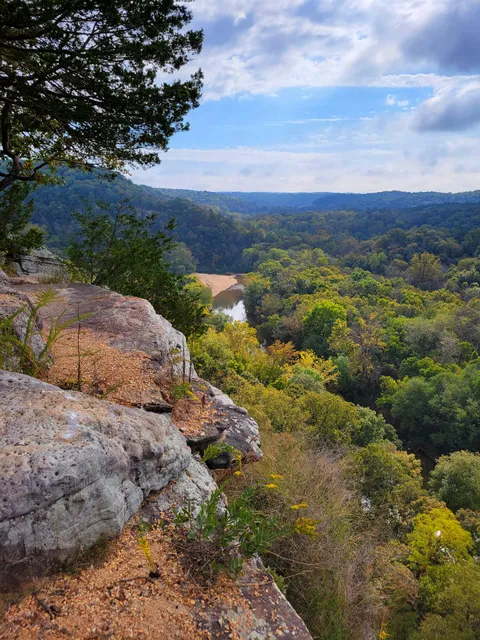
Kings River Overlook
Huntsville, AR 72740
4.7(75)
Open until 12:00 AM
Save
spot
spot
Ratings & Description
Info
attractions: Kings River Overlook Nature Trail Head, restaurants:
Open hoursSee all hours
MonOpen 24 hoursOpen
Plan your stay

Pet-friendly Hotels in Huntsville
Find a cozy hotel nearby and make it a full experience.

Affordable Hotels in Huntsville
Find a cozy hotel nearby and make it a full experience.

The Coolest Hotels You Haven't Heard Of (Yet)
Find a cozy hotel nearby and make it a full experience.

Trending Stays Worth the Hype in Huntsville
Find a cozy hotel nearby and make it a full experience.
Reviews
Nearby attractions of Kings River Overlook
Kings River Overlook Nature Trail Head
Kings River Overlook Nature Trail Head
4.8
(30)
Open 24 hours
Click for details
Things to do nearby

SixtyOn with Mike Gruning and Michael Welch LIVE at the Gravel Bar at Wanderoo Lodge
Thu, Jan 8 • 5:00 PM
Wanderoo Lodge and Gravel Bar, Morgan Real Estate & Associates, 230 W Van Buren, Eureka Springs, AR 72632, United States
View details

Community Candlelight Celebration
Thu, Jan 8 • 5:30 PM
Basin Spring Park, Historic Crescent Hotel, Center St, Eureka Springs, AR 72632, United States
View details

Start 2026!
Thu, Jan 8 • 6:00 PM
1 Country Club Dr, Holiday Island, AR 72631-5106, United States, 1 Country Club Dr, Holiday Island, AR 72631-5106, United States, Beaver
View details


