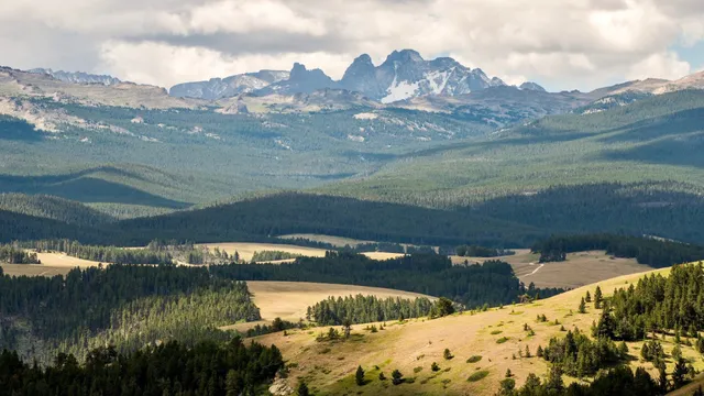
Last year I spent four months at the base of the Bighorn Mountains while working on a construction project for the town of Lovell and a local utility company. I've never been mountains quite like this. It is incredible, especially going up from the west side.
There are two main roads going that way, and they both have spectacular scenery. I prefer the southern road on US highway 14 starting in the wonderfully scenic and friendly town of Greybull on the west side and then going east on the highway to the small town of Shell. There are pits of small hot springs and colorful rock and mud that is at the Devil's Playground where there are paint pots you can get directed to the site by either a friendly local in Greybull, or watch for a small sign on Hwy 14 that shows where to turn off of the highway and then go north a couple of miles. With luck you can find the deep depression with it's interesting scenery and colorful rock and soil. It's quite interesting...but I'd recommend you get directions from Greybull instead of trying to find the right county road yourself.
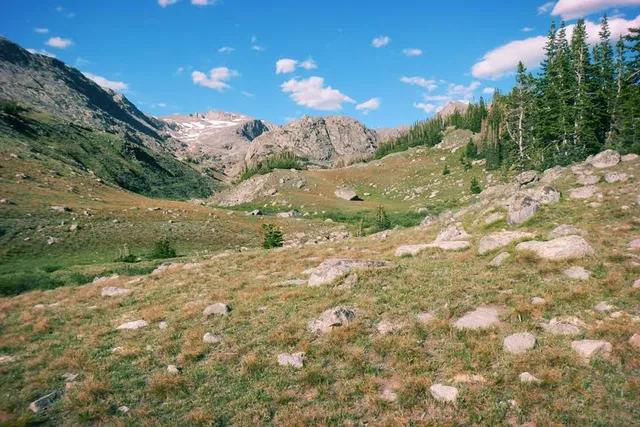
Going up the escarpment on US 14 you'll see a number of small scenic pull outs that I'd recommend you stop at and go ahead, gawk at the views and the interesting rock formations you'll find. It's truly awe inspiring. Eventually you'll reach Burgess Junction where the other, larger road comes across the mountain but started further north than Hwy 14. Continue up a little bit, but then you'll start down the mountain in a breathtaking series of wide sweeping turns as you plummet down the mountainside before finally reaching Ranchester and Interstate 90.
The only other suggestion I would have that truly would take your breath away, is starting back on the West side at the little cow town of Lovell. A must see is to stop at the Bighorn Canyon National Recreation Center just at the east edge of town where you turn north on US Hwy 14A (sister to US 14 I described above). The visitor center is just on the right as you turn off E Main St onto 14A. Lots to see there, including a short video about the Big Horn River and Bighorn Lake, a number of books about the local area and maps!!! I love maps and they've got some good ones there that will satisfy the heart of any map-o-phile. Be sure to talk to the National Park rep at the desk and they can give you some really great ideas on what to do in the Recreation area.
My favorite way up the west side of the mountains there is to continue east on 14A, crossing the large reservoir formed by a dam on the Bighorn River, then turn left towards Cottonwood Campground. You pull in close to the reservoir a couple of times and then you see a little dirt road ahead that goes up the side of a mountain. If you want a bit of a thrill and are adventurous, turn left onto that road and go up. You;ll pass a small parking area, but stay left and start up the hillside. Just keep on going, you'll see incredible sights, the reservoir from up above and any number of wildlife as you continue up the mountain, pronghorn antelope, perhaps a moose or elk, even possible to see a cougar and bobcat. You're in pretty wild country. If you go far enough (~10 or so miles), you'll climb some rugged parts of the dirt road (4-wheel drive only up here), you'll come to a Medicine Wheel area that was put up there at least 30-40 years ago. A lady in Lovell said her grandpa and a group of boy scouts were doing merit badges long past, and decides to re-establish the Medicine wheel that had been in the area with the Crow tribe in that area. It has since been protected by the BLM and the tribe has adopted it as one of the truly significant 'good acts' by the whites since after the Battle Little Bighorn (Custer's battle, further north into Montana about 40 miles - but that's another story!). Just past the Medicine Wheel the road ties back into US 14A just before getting to Burgess Junction and the rejoinder of US 14 described above.
Have a...
Read more