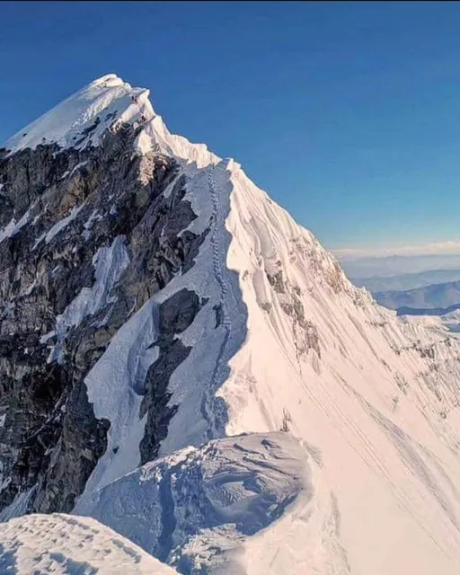
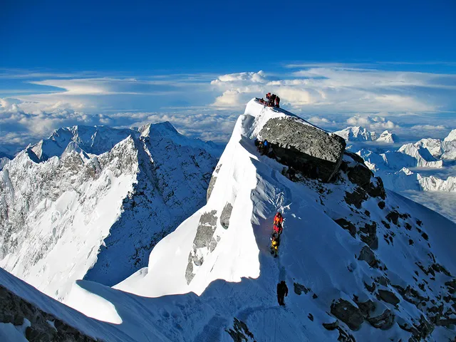
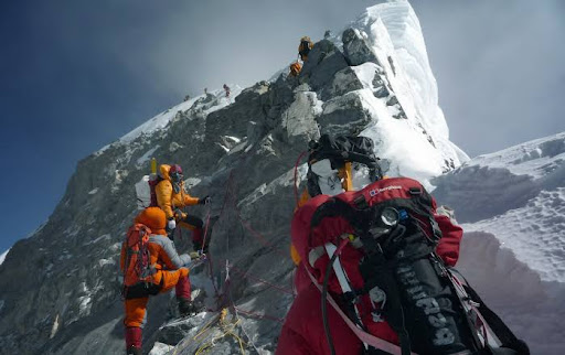
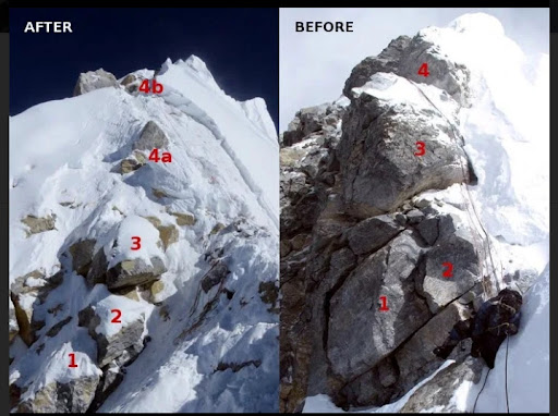
The Step was known as the most technically difficult part of the typical Nepal-side Everest climb.In some climbing seasons after heavy snowfall, the rock face could have been bypassed with snow/ice climbing.Climbing the Hillary Step has the danger of a 10,000-foot (3,000 m) drop on the right (when going up) and an 8,000-foot (2,400 m) drop on the left The Hillary Step was where Anatoli Boukreev found a body hanging from ropes at the base of the step in 1996, as stated in his book One expedition noted that climbing the Hillary Step was "strenuous", but did offer some protection from the elements An unaided Hillary Step climb was rated as a Class 4 rock climb, but at almost 29,000-foot (8,800 m) altitude
The Hillary Step was destroyed by an earthquake that struck the region in 2015.
History
The Step was named after Sir Edmund Hillary, who was the first known person, along with Tenzing Norgay, to scale it on the way to the summit during the 1953 British Mount Everest Expedition. Hillary and Tenzing first climbed the Hillary Step on 29 May 1953 by climbing the crack between the snow and the rock.Hillary reported that the snow on the step was harder than at lower elevation.Hillary wrote in 1953 (the reference to Tenzing being hauled up like a fish rankled with Tenzing, and the "fish" simile disappeared from later accounts):
After an hour’s steady going we reached the foot of the most formidable-looking problem on the ridge – a rock step some forty feet [12m] high. We had known of the existence of this step from aerial photographs, and had also seen it through our binoculars from Thyangboche. We realised that at this altitude it might well spell the difference between success and failure. The rock itself, smooth and almost holdless, might have been an interesting Sunday afternoon problem for a group of expert rock climbers in the Lake District, but here it was a barrier beyond our feeble strength to overcome. I could see no way of turning it on the steep rock bluff on the west, but fortunately another possibility of tackling it still remained. On its east side was another great cornice, and running up the full forty feet of the step was a narrow crack between the cornice and the rock. Leaving Tenzing to belay me as best he could, I jammed my way into this crack, then kicking backwards with my crampons I sank their spikes deep into the frozen snow behind me and levered myself off the ground. Taking advantage of every little rock hold and all the force of knee, shoulder and arms I could muster, I literally cramponed backwards up the crack, with a fervent prayer that the cornice would remain attached to the rock. Despite the considerable effort involved, my progress although slow was steady, and as Tenzing paid out the rope I inched my way upwards until I could finally reach over the top of the rock and drag myself out of the crack on to a wide ledge. For a few moments I lay regaining my breath and for the first time really felt the fierce determination that nothing now could stop us from reaching the top. I took a firm stand on the ledge and signalled to Tenzing to come on up. As I heaved hard on the rope Tenzing wriggled his way up the crack and finally collapsed exhausted at the top like a giant fish when it has just been hauled from the sea after a terrific struggle.
The step had been seen by the first assault party of Tom Bourdillon and Charles Evans when they reached the South Summit on 26 May 1953 at 1 pm (too late to attempt the summit). Seated on the snow dome, they could look closely at the last 300 vertical feet [90m] to the Summit. It was not the gentle snow ridge they’d hoped for ... but a thin crest of snow and ice on rock, steep on the left, overhanging as a cornice on the right. It was interrupted by a formidable-looking 40 foot [12m] rock step two-thirds...
Read more