Rockbridge State Nature Preserve things to do, attractions, restaurants, events info and trip planning

Basic Info
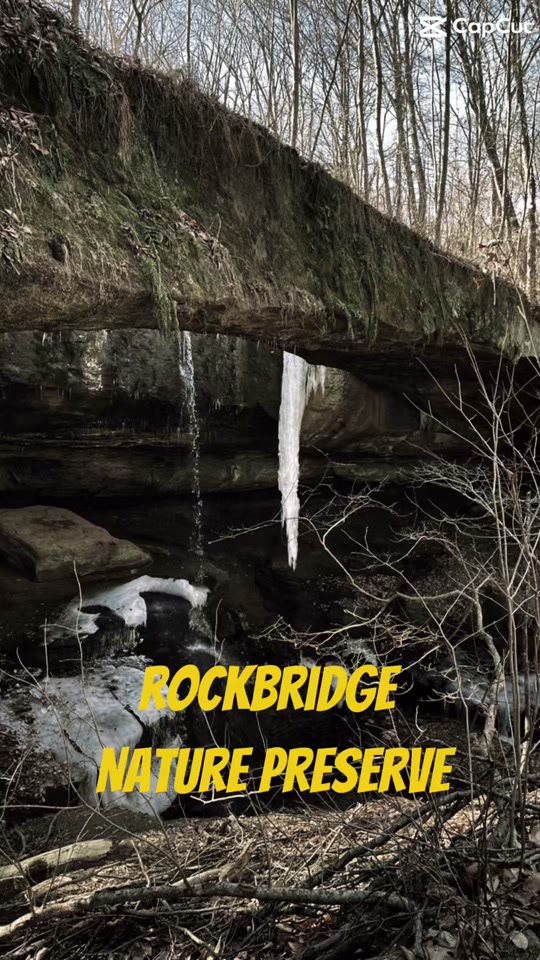
Rockbridge State Nature Preserve
11475 Dalton Rd, Rockbridge, OH 43149
4.7(378)
Open 24 hours
Save
spot
spot
Ratings & Description
Info
Rockbridge State Nature Preserve is a nature reserve featuring a natural bridge located in the unincorporated community of Rockbridge in Hocking County, Ohio, United States.
Outdoor
Adventure
Scenic
Family friendly
Pet friendly
attractions: , restaurants: , local businesses: Buffalo Cabins and Lodges, Don Wood Chrysler Dodge Jeep Ram
Phone
(614) 265-6453
Website
ohiodnr.gov
Plan your stay

Pet-friendly Hotels in Logan
Find a cozy hotel nearby and make it a full experience.

Affordable Hotels in Logan
Find a cozy hotel nearby and make it a full experience.

The Coolest Hotels You Haven't Heard Of (Yet)
Find a cozy hotel nearby and make it a full experience.

Trending Stays Worth the Hype in Logan
Find a cozy hotel nearby and make it a full experience.
Reviews
Live events

Valerie June
Fri, Feb 13 • 12:30 AM
Stuart's Opera House, 52 Public Square, Nelsonville, OH 45764, US, United States
View details

Valentines Day Tisane and Tea Blending Sip
Sat, Feb 14 • 1:00 PM
3080 Kauffman rd Carroll Ohio 43112, 3080 Kauffman Rd, Carroll, OH 43112-9502, United States
View details

Sweetheart Community Dinner
Sat, Feb 14 • 4:30 PM
30 E. Columbus St., 30 E Columbus St, Nelsonville, OH 45764-1202, United States
View details
Nearby local services of Rockbridge State Nature Preserve
Buffalo Cabins and Lodges
Don Wood Chrysler Dodge Jeep Ram
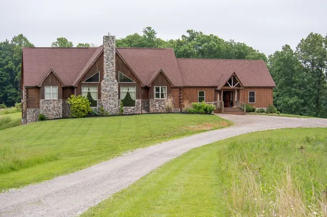
Buffalo Cabins and Lodges
4.7
(448)
Click for details

Don Wood Chrysler Dodge Jeep Ram
4.7
(395)
Click for details