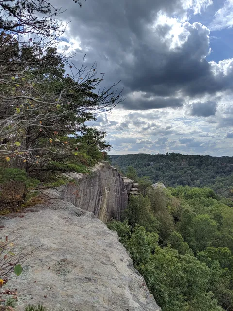
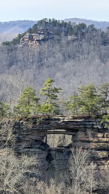
As many people confirmed online, the Auxier Ridge Trail provided the best views we saw on our trip, so I highly recommend this trail but we have not hiked any others on the Red River Gorge side of the parkway.
Directions:
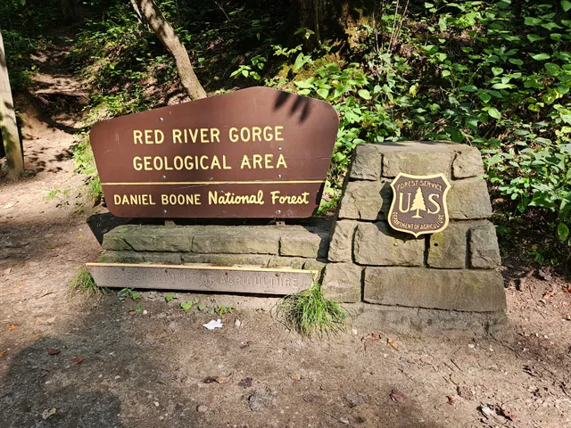
Take the Slade exit off the Bert Combs Mountain Parkway to start. Take the road that goes by the Shell station which is Campton Road. Go south on Campton Rd. It winds south along the Bert Combs Mountain Parkway. Watch carefully for it, then take a left onto Tunnel Ridge Rd. You almost immediately cross a one lane bridge. After that the road is gravel but well-maintained (a few larger potholes) and leads up to the Auxier Ridge trailhead.
Parking:
We went on Labor Day weekend and it was crowded but luckily we did find a spot to park on the very last parking lot on the Gravel Road. There are many parking places along the road but to hike the Auxier Ridge Trail you want to go to the very last spot indicated on the map by the small traffic circle. Don't forget your 1 or 3 Day parking pass that must be displayed in your car overnight. Available at retailers near you or at the Shell station there in Slade.
The trail:
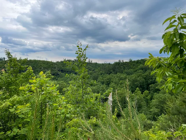
My 12 year old son and I hiked the 5.9 mile Double Arch - Courthouse Rock - Auxier Ridge Trail Loop in a clockwise direction. We were both carrying heavy backpacks with plans for doing a two-night overnight but we only ended up staying for one night due to his getting sick and our lack of preparation for the heat which was pretty stifling in both tent and hammock until well after dark. Check the weather carefully and bring a battery operated fan if you go during hot weather season. This Trail loop is listed as moderate and has some pretty steep inclines and declines along the way where you have to scramble up some carved stone steps and navigate some slightly iffy places.
Camping:
As someone suggested we met on the trail, we camped down by the stream at the bottom of the valley AFTER Double Arch trail and BEFORE Courthouse Rock. It's a little hard to tell where or where not to camp since some of the signs are placed ambiguously on trees. We estimated 300 feet from the trail as required by the park service and camped about that far up a hill from the creek and trail on a small semi level area. Not ideal but within Park regulations. If we would have gone a bit further there was a better space that was large and flat near the creek but also the appropriate distance from the trail. We saw one Ranger on the trail talking to someone else about camping too close to the trail, and it looked like he was writing them a ticket or a warning, so they do check.
Bear cannisters:
Just be forewarned that signs throughout the park said a bear canister was required. We hung ours 10 foot high and 4 ft away from a tree trunk so we were in compliance. From everything I read it appeared to be only optional. A Google search seemed to confirm that the last bear spotted in the park was in 2016, and that was a rare sighting so we were not worried at all.
Snakes:
The only snake I saw was a very tiny baby yellow banded black snake slithering quickly across the trail in front of me that was 3 to four inches long. We have seen a rather large rattlesnake in Daniel Boone Natural Bridge Park but that was years ago and very rare apparently. So if you're worried, it's not too common as far as I know to see snakes but I'm sure they are there.
The trail was great just wish my son had not got sick but don't let that prevent you from going and having a great day or two hiking...
Read more