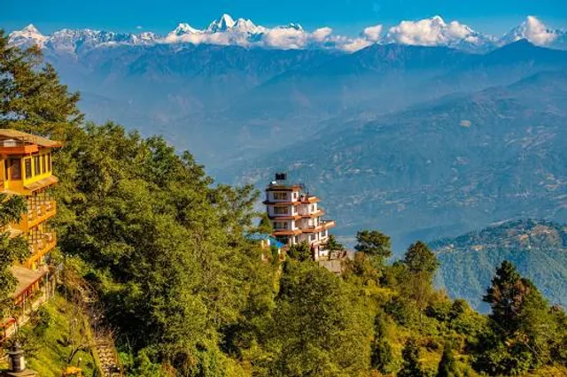
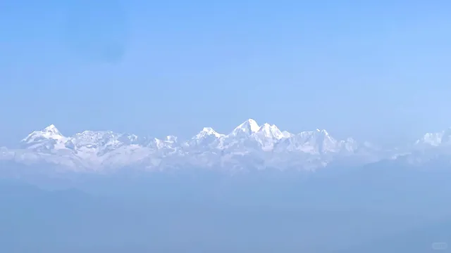
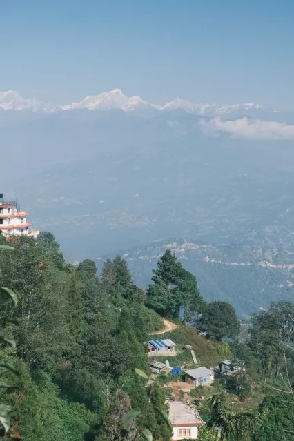
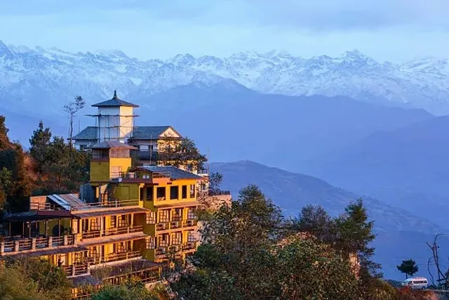
Nagarkot is a former Village Development Committee located 32 km east of Kathmandu, Nepal in Bhaktapur District in Bagmati Pradesh and as of 2015 part of Nagarkot Municipality. At the time of the 2011 census it had a population of 4571 and had 973[1] houses in it.[2] At an elevation of 2,195 meters, it is considered one of the most scenic spots in Bhaktapur District. It is known for a sunrise view of the Himalayas including Mount Everest as well as other peaks of the Himalayan range of eastern Nepal. Nagarkot also offers a panoramic view of the Kathmandu Valley.[3] The scenic beauty of the place makes it a very popular hiking route for tourists.[4] It is located approximately 7000 ft (2000 m) above sea level and 28 km from Kathmandu International Airport.
Nagarkot
नगरकोट
(anciently known as Mandapgiri)
former Village Development Committee Hill station
Nickname(s):
Mandapgiri


Nagarkot
Location in Nepal
Coordinates: 27.7236°N 85.5247°ECountry NepalProvinceBagmati PradeshDistrictBhaktapur DistrictAreaChangunarayanElevation
2,175 m (7,136 ft)Population
(1991)
• Total3,504 • Religions
HinduTime zoneUTC+5:45 (NST)Postal code
44812
Area code(s)01 Nagarkot commands one of the broadest views of the Himalayas in the Kathmandu valley (8 Himalayan ranges of Nepal out of 13 from here). The ranges include Annapurna range, Manaslu range, Ganesh himal range, Langtang range, Jugal range, Rolwaling range, Mahalangur range (Everest range) and Numbur range with views of the Kathmandu valley and Shivapuri National Park. 
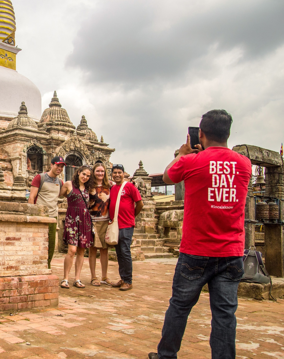
For those active nature lovers and outdoor enthusiasts, there are many hiking opportunities in and around Nagarkot. Among them, Nagarkot eco trail (nature walk) along with Nagarkot panoramic hiking trail is the most popular ones. You can also do Paragliding with Everest view in Nagarkot. Situated in a strategic location, Nagarkot was an ancient fort of the Kathmandu valley built to monitor the external activities of other kingdoms. Later, it became a summer retreat for the royal family before becoming popular as an international hill station. Lots of Homestay also offer for tourists or travellers as a hospitality industry like GoGreek Kattike Resort & Homestay, Kattike Bhanjyang Shankharapur-3 Nagarkot. Size of this preview: ८०० × ६०० pixels. Other resolutions: ३२० × २४० pixels | ६४० × ४८० pixels | १,०२४ × ७६८ pixels | १,२८० × ९६० pixels | २,०४८ × १,५३६ pixels.
Original file (२,०४८ × १,५३६ pixels, file size: ५७१ KB, MIME type: image/jpeg)
This file is from Wikimedia Commons and may be used by other projects. The description on its file description page there is shown below.
Summary
Description
English: Geodetic Survey Tower Nagarkot Nepal1
Dateअक्टोबर २८, ई सं २०११SourceOwn workAuthorसरोज कुमार ढकाल
Licensing
I, the copyright holder of this work, hereby publish it under the following license:
   This file is licensed under the Creative Commons Attribution-Share Alike 3.0...
Read moreThe popularity of trekking and mountaineering in the Himalayas led to the rise of tourism in Nagarkot during the 1970s.
Structure: ◉ The Nagarkot Geodetic Survey Tower (which is a 30 foot or so iron tower with a small deck) is a notable landmark situated on a hilltop. At approximately 2,195 meters above sea level, it is found at the edge of the ridge.
Mode of transportation and Distance: ◉ Nagarkot's main town is approximately 3 km away from this place. Taking the public bus requires walking for 25-30 minutes on paved roads. You can also take a taxi from the bus stop to get to the tower.
Road’s condition: ◉ Being situated at a high elevation, the tower is an ideal spot for capturing panoramic views. Accessing the tower can be a challenge because of the narrow roads leading up to it. Because these roads are shared by both vehicles and pedestrians, it can lead to congestion since they are not wide enough for two vehicles to pass simultaneously. To navigate through, temporary driveways must be created. The access roads are in poor condition; they are gravelly and bumpy because of lack of maintenance, negligence, and delays.
Experience at Tower: ◉ Once inside the tower, visitors can take in stunning views that would otherwise be blocked by the hills and trees surrounding them from the ground up. Clear days allow for far-reaching observations of Magnificent Mount Everest due to the tower's significant enhancement in visibility. In the surrounding area, there is a plethora of lush greenery, terraced fields, and picturesque villages. ◉ While the observation tower itself provides an excellent viewing platform, there are some safety concerns associated with its structure; climb through ladders (steel staircase in the tower is steep). Additionally, there is an entry fee required to access the tower. ◉ The tower's vicinity has its own set of difficulties. The natural beauty of the location is detracted from due to an obvious accumulation of rubbish on one side of the ground.
Despite there being shops and eateries available along the road leading to the tower, their lack of electricity may limit their offerings. Visitors can still appreciate the natural coolness of the area, even with these drawbacks.
Ideal time to visit: ◉ Between October and April is when the best time to visit is. The weather during this period is relatively clear and dry, which creates the ideal conditions for sightseeing and photography.
Activities to take part in Nagarkot View Point Tower: ◉ Sunrise and sunset Viewing ◉ Nature photography ◉ Hiking to Changu Narayan, a UNESCO world heritage site ◉ Mountain biking ◉ Bird watching ◉ Cultural village tour ◉ Meditation and yoga retreat Camping
Note: ◉ Although the entire hilltop area is part of an army camp, most people and vehicles can pass through without issue, except for occasional stops for...
Read moreNagarkot situated at a distance of 32 km from Kathmandu and 20 km from Bhaktapur is a favorite destination among both forign and domestic tourists. Located at an altitude of 2000m. Nagarkot is famous for viewing sunrise, sunset and a magnificent view of the Langtang range. Green hills, clean and fresh environment and the unobstructed views of Langtang range are the main features of Nagrkot. One can expeience a majestic view of a whole range of mountains from Nagarkot extending from Mt Dhaulagir in the west to Mt Everest in the East. The weather is quite cold here during winter. The moring view of the Kathmandu valley covered in fog and the first rays of sunlight hitting the hilltop fascinates every heart. tourists adore taking snps of the scene unmatched anywhere else. Most hotels here are located at the top of hillocks and most of them are constructed in such a way to provide the best views of the nature and moutnain from the rooms. the evening view of the city lights are another attraction of the place. surrounded between green hills and taking phtographs of the natural beautry while strolling in the cool breeze leave an unforgettable memory of Nagarkot, That is why, most tourist who come here for a short visit extend their stay falling under the magic of Nagarkot. Nagarkot is considered an ideal spot to escape from the polluted environment and hectic city life. the hill station is teemed with a large number of high standard hotels and resorts. The Nagarkot View Tower is a magnet for nature lovers who reach there to capture the scenes of rising sun in the morning and when it is setting in the evening. Be it the majestic view of the rows of snowcapped mountains or the birds eye view of the Kathmandu Valley seen from the View Tower located at the highest point of Nagarkot, tourists adore the views. The Langtang range could be viewed far better from here. The viewed far better from here. The tower is located at an altitude of 2100 meter and offers a panoramic view of Kathmandu valley as well as most parts of Kavre and Sindhupalchok. During the tourist season, people flock to the 30m metal tower to have an unobstructed view of the surrounding natural beauty and to take snaps with their camera. Located at a short distance of the tower there is a temple of Lord Shiva where a huge fair is organised every year on the Janai...
Read more