Stetattle Creek Trailhead things to do, attractions, restaurants, events info and trip planning

Basic Info
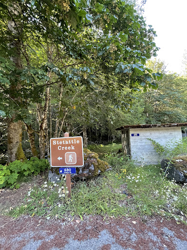
Stetattle Creek Trailhead
Rockport, WA 98283
3.5(5)
Open 24 hours
Save
spot
spot
Ratings & Description
Info
Outdoor
Adventure
Scenic
Pet friendly
Off the beaten path
attractions: Sourdough Mountain Trailhead, Pyramid Lake Trailhead, restaurants: , local businesses:
Plan your stay

Pet-friendly Hotels in Area E (Chilliwack River Valley)
Find a cozy hotel nearby and make it a full experience.

Affordable Hotels in Area E (Chilliwack River Valley)
Find a cozy hotel nearby and make it a full experience.

The Coolest Hotels You Haven't Heard Of (Yet)
Find a cozy hotel nearby and make it a full experience.

Trending Stays Worth the Hype in Area E (Chilliwack River Valley)
Find a cozy hotel nearby and make it a full experience.
Reviews
Nearby attractions of Stetattle Creek Trailhead
Sourdough Mountain Trailhead
Pyramid Lake Trailhead

Sourdough Mountain Trailhead
4.8
(20)
Open until 12:00 AM
Click for details

Pyramid Lake Trailhead
4.5
(16)
Open until 12:00 AM
Click for details