Hazelwood Trail things to do, attractions, restaurants, events info and trip planning
Basic Info
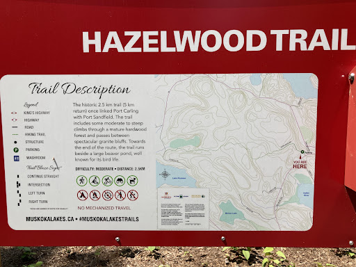
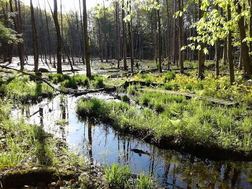
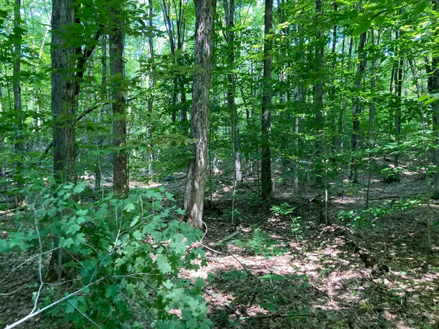
Hazelwood Trail
Port Carling, ON P0B 1J0, Canada
4.1(11)
Open 24 hours
Save
spot
spot
Ratings & Description
Info
Outdoor
Adventure
Scenic
Pet friendly
Family friendly
Off the beaten path
attractions: Port Carling Wall, Muskoka Cruises, Port Carling Locks, restaurants: Turtle Jack's Port Carling, Coop Wicked Chicken & Bar Port Carling, Tulo's Taqueria Muskoka, York & Mason, Pete's Links, Beveragino, Portside Fusion Restaurant, The Hut Smoothie and Juice Bar, Bakery by the Lake, Duke's Live Music, local businesses:
Plan your stay

Pet-friendly Hotels in District Municipality of Muskoka
Find a cozy hotel nearby and make it a full experience.

Affordable Hotels in District Municipality of Muskoka
Find a cozy hotel nearby and make it a full experience.

The Coolest Hotels You Haven't Heard Of (Yet)
Find a cozy hotel nearby and make it a full experience.

Trending Stays Worth the Hype in District Municipality of Muskoka
Find a cozy hotel nearby and make it a full experience.
Reviews
Nearby attractions of Hazelwood Trail
Port Carling Wall
Muskoka Cruises
Port Carling Locks

Port Carling Wall
4.7
(216)
Open until 12:00 AM
Click for details

Muskoka Cruises
4.4
(131)
Open 24 hours
Click for details

Port Carling Locks
4.6
(12)
Open until 12:00 AM
Click for details
Nearby restaurants of Hazelwood Trail
Turtle Jack's Port Carling
Coop Wicked Chicken & Bar Port Carling
Tulo's Taqueria Muskoka
York & Mason
Pete's Links
Beveragino
Portside Fusion Restaurant
The Hut Smoothie and Juice Bar
Bakery by the Lake
Duke's Live Music

Turtle Jack's Port Carling
4.1
(786)
$$
Click for details
Coop Wicked Chicken & Bar Port Carling
4.1
(113)
Open until 12:00 AM
Click for details
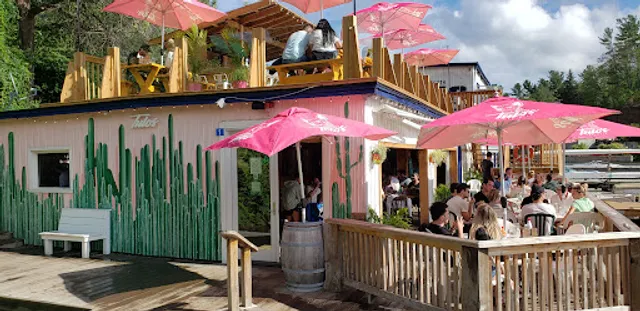
Tulo's Taqueria Muskoka
3.2
(181)
Click for details

York & Mason
4.7
(123)
Click for details