Town Belt walk things to do, attractions, restaurants, events info and trip planning
Basic Info
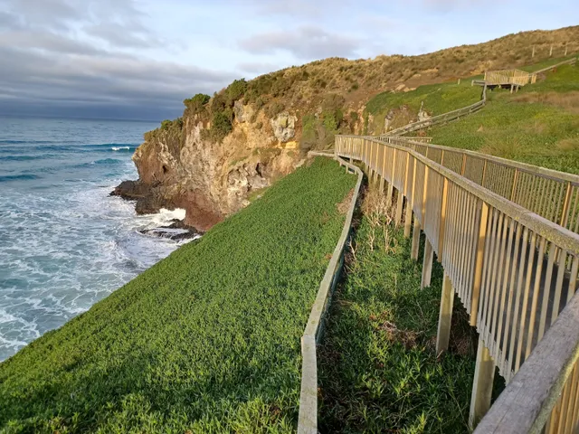
Town Belt walk
Central Dunedin, Dunedin 9011, New Zealand
4.1(24)
Open 24 hours
Save
spot
spot
Ratings & Description
Info
Outdoor
Adventure
Scenic
Pet friendly
Family friendly
Off the beaten path
attractions: The Oval, Leap Dunedin, Southern Cemetery, Unity Park Lookout, Unity Park, Mayfair Theatre, Mornington Park, Jubilee Park, Dunedin Gasworks Museum, restaurants: The Kensington Sports Bar & Tavern, 印象Impression Restaurant Dunedin, Hell Pizza Dunedin South, Pizza Hut Dunedin South, Common Ground Espresso, Hashi Japanese Cuisine South Dunedin, Indian Spice Dunedin South, wildbean cafe, Pie Hub, Adana Turkish Kebab, local businesses: PAK'nSAVE Dunedin, Dunedin Hunting & Fishing New Zealand, Bunnings Warehouse Dunedin, Kayla Drinkwater Physio (KD Physio), Harvey Norman Dunedin (Electrical Outlet), Sew Hoy Oriental Foods, Hot Spring Spas Dunedin, Origin Fresh Food Store
Plan your stay

Pet-friendly Hotels in South Island
Find a cozy hotel nearby and make it a full experience.

Affordable Hotels in South Island
Find a cozy hotel nearby and make it a full experience.

The Coolest Hotels You Haven't Heard Of (Yet)
Find a cozy hotel nearby and make it a full experience.

Trending Stays Worth the Hype in South Island
Find a cozy hotel nearby and make it a full experience.
Reviews
Live events

Yoga For Beginners - 8 Week Course
Wed, Feb 11 • 7:00 PM
Soma Yoga, 7 Crawford St, Dunedin Central, Dunedin 9016, New Zealand, Dunedin
View details

Soma Yoga 8 week Journey | THURSDAY 7:30PM
Wed, Feb 11 • 8:30 PM
7 Crawford Street, Dunedin, New Zealand
View details

Jewellery Introduction - Thursday (8 week duration) Term 1 2026
Thu, Feb 12 • 5:00 AM
Dunedin School of Art, 19 Riego Street, Dunedin, New Zealand
View details
Nearby attractions of Town Belt walk
The Oval
Leap Dunedin
Southern Cemetery
Unity Park Lookout
Unity Park
Mayfair Theatre
Mornington Park
Jubilee Park
Dunedin Gasworks Museum

The Oval
4.5
(45)
Open until 12:00 AM
Click for details

Leap Dunedin
4.5
(222)
Closed
Click for details

Southern Cemetery
4.6
(15)
Open 24 hours
Click for details

Unity Park Lookout
4.4
(171)
Open until 12:00 AM
Click for details
Nearby restaurants of Town Belt walk
The Kensington Sports Bar & Tavern
印象Impression Restaurant Dunedin
Hell Pizza Dunedin South
Pizza Hut Dunedin South
Common Ground Espresso
Hashi Japanese Cuisine South Dunedin
Indian Spice Dunedin South
wildbean cafe
Pie Hub
Adana Turkish Kebab
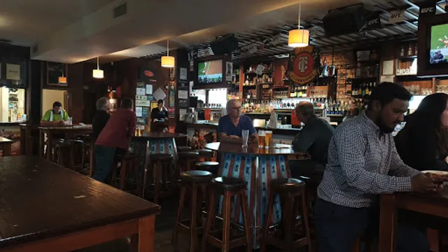
The Kensington Sports Bar & Tavern
4.2
(438)
Closed
Click for details
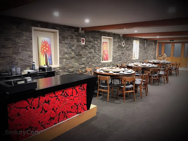
印象Impression Restaurant Dunedin
4.6
(233)
Closed
Click for details
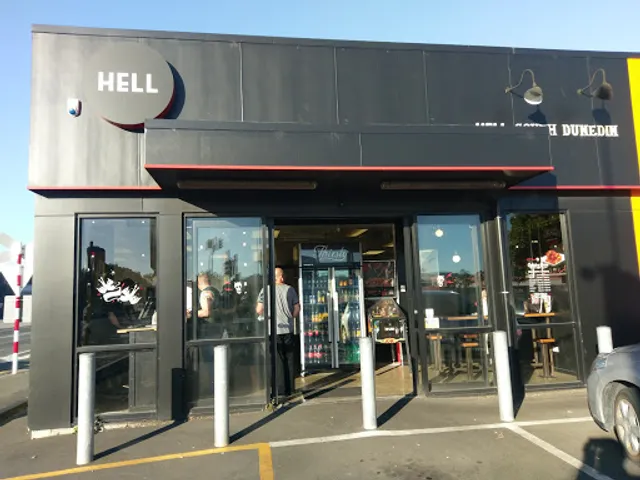
Hell Pizza Dunedin South
4.2
(210)
$$
Closed
Click for details

Pizza Hut Dunedin South
4.4
(559)
Closed
Click for details
Nearby local services of Town Belt walk
PAK'nSAVE Dunedin
Dunedin Hunting & Fishing New Zealand
Bunnings Warehouse Dunedin
Kayla Drinkwater Physio (KD Physio)
Harvey Norman Dunedin (Electrical Outlet)
Sew Hoy Oriental Foods
Hot Spring Spas Dunedin
Origin Fresh Food Store

PAK'nSAVE Dunedin
4.1
(1.5K)
Click for details

Dunedin Hunting & Fishing New Zealand
4.5
(303)
Click for details
Bunnings Warehouse Dunedin
4.2
(1.0K)
Click for details

Kayla Drinkwater Physio (KD Physio)
5.0
(34)
Click for details


