Braemar Hill Peak things to do, attractions, restaurants, events info and trip planning

Basic Info
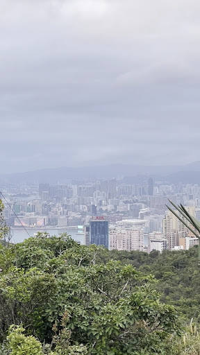
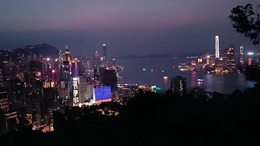
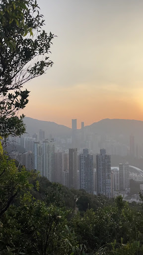
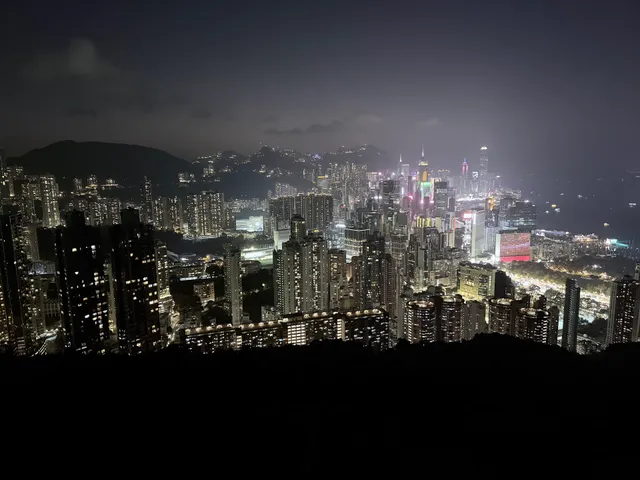
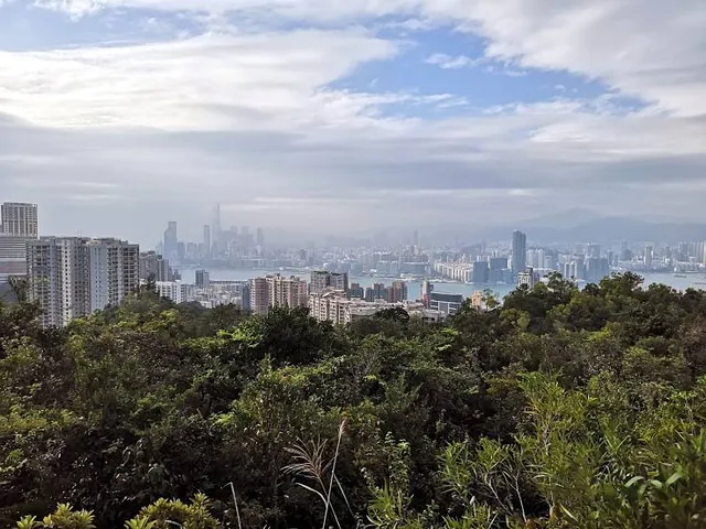
Braemar Hill Peak
Tai Tam, Hong Kong
4.5(100)
Open until 12:00 AM
Save
spot
spot
Ratings & Description
Info
Outdoor
Adventure
Scenic
attractions: Red Incense Burner Summit, Braemar Hill photo rock, Braemar Hill Road Playground, Haw Par Mansion, Braemar Hill, Tai Hang Lin Fa Kung, Tin Hau Temple, Causeway Bay, Choi Sai Woo Park, Tai Hang Fire Dragon (Mid-Autumn Festival), Chinese Rhenish Church Wanchai, restaurants: Coffee 101, Bing Kee Cha Dong, Ask for Alonzo (Tai Hang), Bak Kut King, Tipsy Restaurant & Bar, Locomotive Contemporary Vietnamese Cuisine, Que Pasa, BKK Taphouse (Bar and Grill), Nocino Tai hang, OMA Specialty Coffee, local businesses: Sir Cecil's Ride Stream Rest Area, Braemar Hill Shopping Centre, Sir Cecil's Ride Stream, Tutor Time Braemar Hill International Nursery & Kindergarten (North Point), Tai Hang Fire Dragon Dance, Braemar Hill Mansions, The Pavilia Hill, Market Place (Cloud View Road 雲景道店), Market Place (Tin Hau 天后店), Dough Bros. Pizza & Doughnuts (Tai Hang)
Open hoursSee all hours
SunOpen 24 hoursOpen
Plan your stay

Pet-friendly Hotels in Hong Kong
Find a cozy hotel nearby and make it a full experience.

Affordable Hotels in Hong Kong
Find a cozy hotel nearby and make it a full experience.

The Coolest Hotels You Haven't Heard Of (Yet)
Find a cozy hotel nearby and make it a full experience.

Trending Stays Worth the Hype in Hong Kong
Find a cozy hotel nearby and make it a full experience.
Reviews
Live events
Festilumi - 香港
Sun, Feb 22 • 7:00 PM
3 Hung Hing Rd, Wan Chai, 00000
View details

Hong Kong Murder Mystery 2: Crime on Date Night!
Sun, Mar 1 • 12:00 AM
Chung Kong Rd, Sheung Wan, 999077
View details

香港的黑暗面 - 九龙笼屋漫步之旅
Sun, Feb 22 • 11:00 AM
太子彌敦道
View details
Nearby attractions of Braemar Hill Peak
Red Incense Burner Summit
Braemar Hill photo rock
Braemar Hill Road Playground
Haw Par Mansion
Braemar Hill
Tai Hang Lin Fa Kung
Tin Hau Temple, Causeway Bay
Choi Sai Woo Park
Tai Hang Fire Dragon (Mid-Autumn Festival)
Chinese Rhenish Church Wanchai

Red Incense Burner Summit
4.6
(592)
Open until 12:00 AM
Click for details
Braemar Hill photo rock
4.9
(21)
Open 24 hours
Click for details
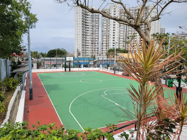
Braemar Hill Road Playground
3.8
(155)
Open until 12:00 AM
Click for details
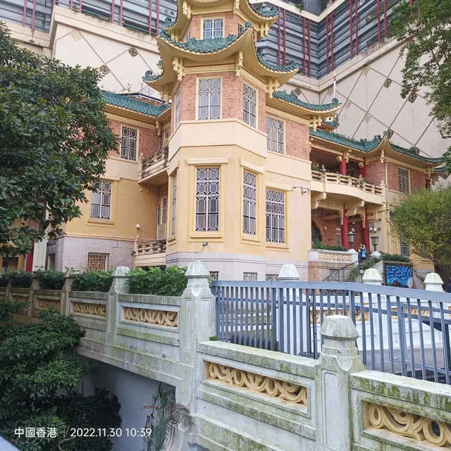
Haw Par Mansion
3.8
(424)
Open 24 hours
Click for details
Nearby restaurants of Braemar Hill Peak
Coffee 101
Bing Kee Cha Dong
Ask for Alonzo (Tai Hang)
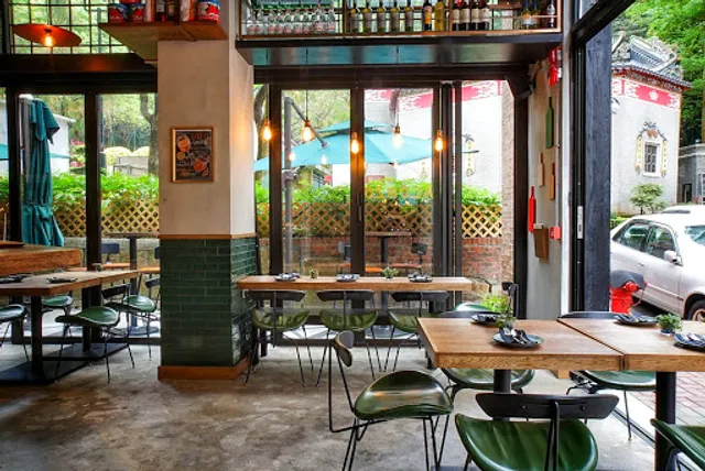
Bak Kut King
Tipsy Restaurant & Bar
Locomotive Contemporary Vietnamese Cuisine
Que Pasa
BKK Taphouse (Bar and Grill)
Nocino Tai hang
OMA Specialty Coffee

Coffee 101
4.1
(96)
Closed
Click for details
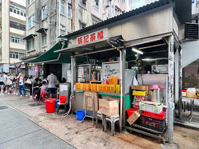
Bing Kee Cha Dong
3.9
(565)
Closed
Click for details
Ask for Alonzo (Tai Hang)
4.4
(194)
Closed
Click for details
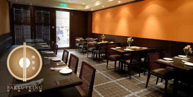
Bak Kut King
3.7
(139)
Closed
Click for details
Nearby local services of Braemar Hill Peak
Sir Cecil's Ride Stream Rest Area
Braemar Hill Shopping Centre
Sir Cecil's Ride Stream
Tutor Time Braemar Hill International Nursery & Kindergarten (North Point)
Tai Hang Fire Dragon Dance
Braemar Hill Mansions
The Pavilia Hill
Market Place (Cloud View Road 雲景道店)
Market Place (Tin Hau 天后店)
Dough Bros. Pizza & Doughnuts (Tai Hang)
Sir Cecil's Ride Stream Rest Area
4.3
(124)
Click for details

Braemar Hill Shopping Centre
3.3
(189)
Click for details
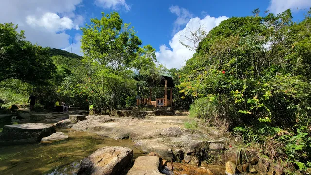
Sir Cecil's Ride Stream
4.3
(12)
Click for details

Tutor Time Braemar Hill International Nursery & Kindergarten (North Point)
4.9
(31)
Click for details