Kannur District things to do, attractions, restaurants, events info and trip planning
Basic Info
Kannur District
Kannur District, Kerala, India
Ratings & Description
Info
Kannur is one of the 14 districts along the west coast in the state of Kerala, India. The city of Kannur is the district headquarters and gives the district its name. The old name, Cannanore, is the anglicized form of the Malayalam name "Kannur". Kannur district is bounded by Kasaragod District to the north, Kozhikode district to the south, Mahé district to the southwest and Wayanad District to the southeast. To the east, the district is bounded by the Western Ghats, which forms the border with the state of Karnataka (Kodagu district). The Arabian Sea lies to the west. Paithalmala is the highest point in Kannur District (1,372m). Enclosed within the southern part of the district is the Mahé district of the Union Territory of Puducherry. The district was...
Read moreKannur is one of the 14 districts along the west coast in the state of Kerala, India. The city of Kannur is the district headquarters and gives the district its name. The old name, Cannanore, is the anglicized form of the Malayalam name "Kannur". Kannur district is bounded by Kasaragod District to the north, Kozhikode district to the south, Mahé district to the southwest and Wayanad District to the southeast. To the east, the district is bounded by the Western Ghats, which forms the border with the state of Karnataka (Kodagu district). The Arabian Sea lies to the west. Paithalmala is the highest point in Kannur District (1,372m). Enclosed within the southern part of the district is the Mahé district of the Union Territory of Puducherry. The district was established in 1957.
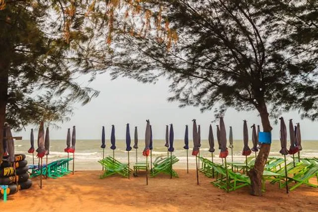
attractions: Parassini Madappura Sree Muthappan Temple, Muzhappilangad Drive In Beach, St. Angelo Fort (Kannur Fort), Thalassery Fort, Sree Peralassery Temple, Vismaya Amusement Park, Sri Rajarajeswara Temple, Mahe River Side Walkway, Madayi Sri Thiruvarkkaattu Kaavu Bhagavati Temple, Kannur Light House, restaurants: Hotel Odhen's, Raandhal Restaurant, MRA Bakery & Restaurant, Rara Avis Restaurant, Barka Restaurant Kannur, CitaPani Restaurant - Kannur, Paris Restaurant (old), Pulari Restaurant Kannur, Cafe Ghazal, MVK Restaurant, local businesses: Parassinikkadavu Snake Park, Chootad Beach, Paithalmala, Payyambalam Beach, Dharmadam Beach Park, Baby Beach, Dharmadam Beach, Muzhuppilangad Drive-in Beach, Peralassery Temple Pond, Tadiandamol
Plan your stay

Pet-friendly Hotels in Kannur District
Find a cozy hotel nearby and make it a full experience.

Affordable Hotels in Kannur District
Find a cozy hotel nearby and make it a full experience.

The Coolest Hotels You Haven't Heard Of (Yet)
Find a cozy hotel nearby and make it a full experience.

Trending Stays Worth the Hype in Kannur District
Find a cozy hotel nearby and make it a full experience.
Reviews
Things to Do in Kannur District, Kerala, India - Kannur District Attractions & Activities
Live events
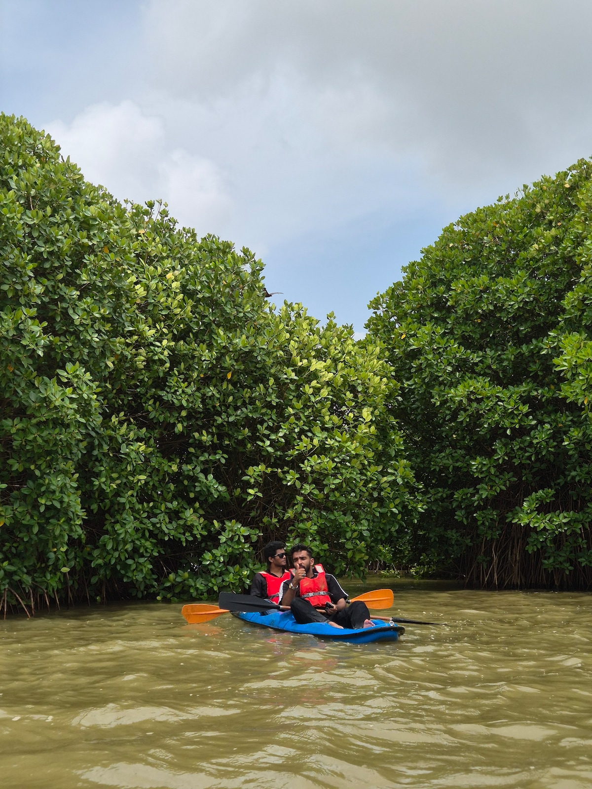
Kayak the Calm Waters of Pulloopi
Sat, Feb 21 • 6:30 AM
Puzhathi, Kerala, 670005, India
View details
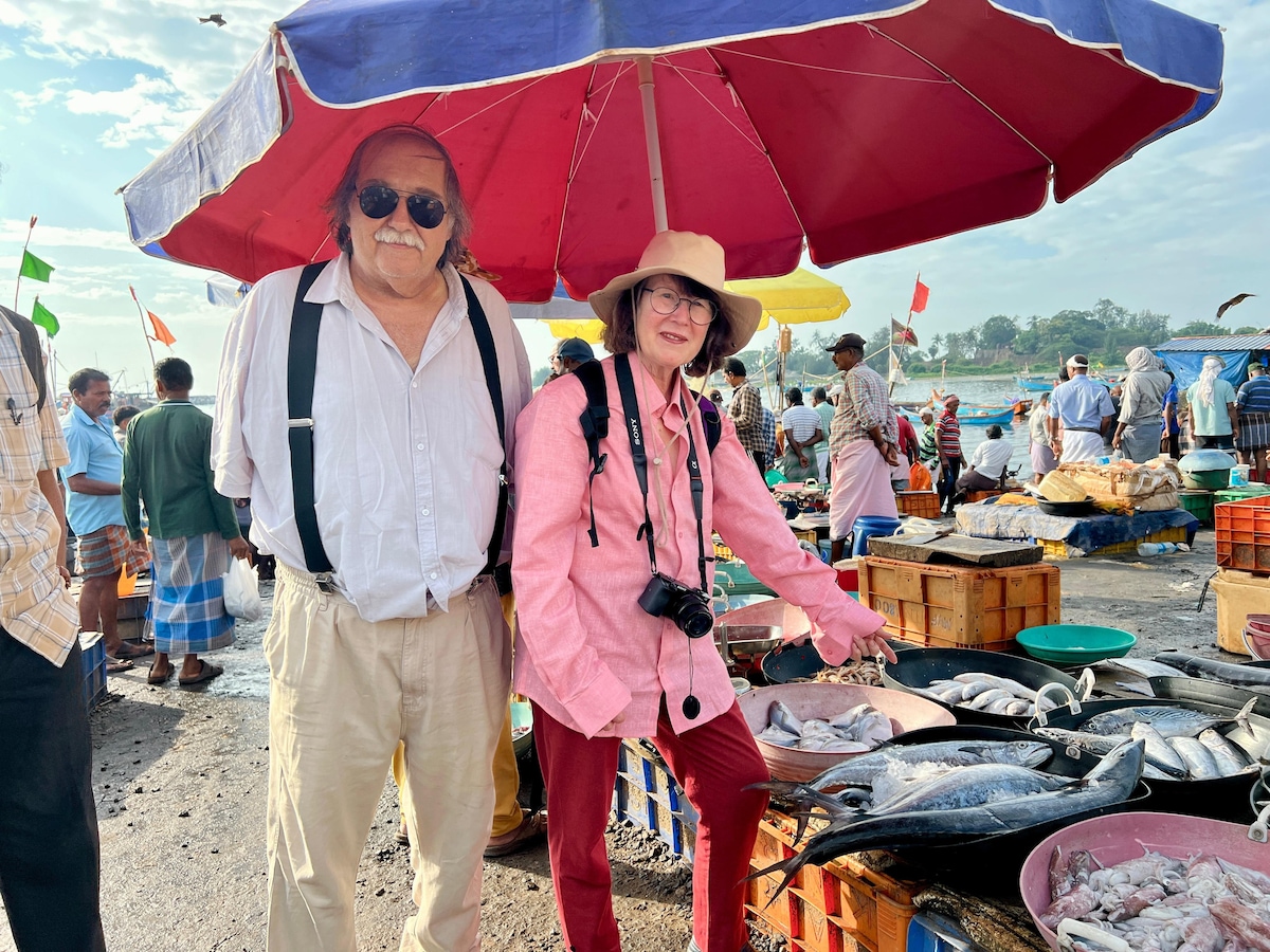
Devour Malabari cuisine in Kannur
Sat, Feb 21 • 9:30 AM
kanhirode Kanhirode, Kerala, 670592, India
View details
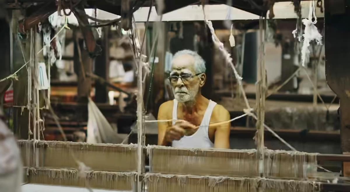
Weavers of Kannur with a fifth generation weaver
Sat, Feb 21 • 10:30 AM
Kannur, Kerala, 670002, India
View details
Attractions of Kannur District
Parassini Madappura Sree Muthappan Temple
Muzhappilangad Drive In Beach
St. Angelo Fort (Kannur Fort)
Thalassery Fort
Sree Peralassery Temple
Vismaya Amusement Park
Sri Rajarajeswara Temple
Mahe River Side Walkway
Madayi Sri Thiruvarkkaattu Kaavu Bhagavati Temple
Kannur Light House
Parassini Madappura Sree Muthappan Temple
4.8
(8.8K)
Closed
Click for details
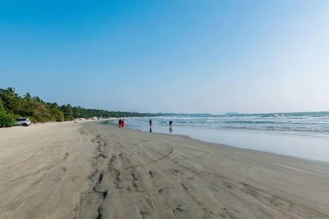
Muzhappilangad Drive In Beach
4.6
(4.9K)
Open 24 hours
Click for details
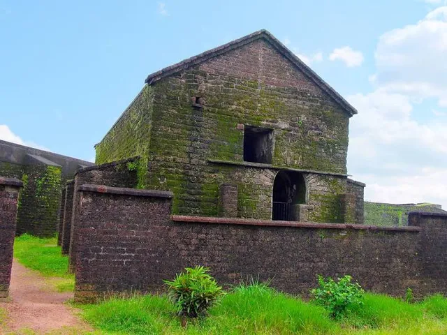
St. Angelo Fort (Kannur Fort)
4.4
(5K)
Closed
Click for details
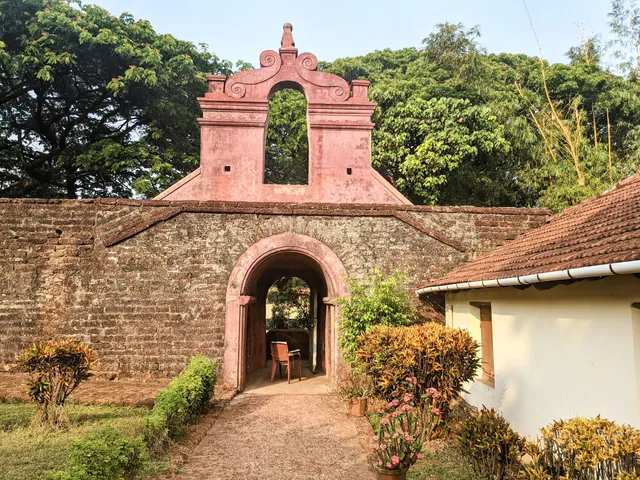
Thalassery Fort
4.2
(3.7K)
Closed
Click for details
Restaurants of Kannur District
Hotel Odhen's
Raandhal Restaurant
MRA Bakery & Restaurant
Rara Avis Restaurant
Barka Restaurant Kannur
CitaPani Restaurant - Kannur
Paris Restaurant (old)
Pulari Restaurant Kannur
Cafe Ghazal
MVK Restaurant
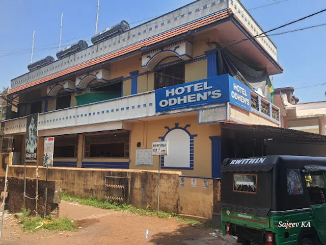
Hotel Odhen's
4.4
(3.5K)
$$
Closed
Click for details
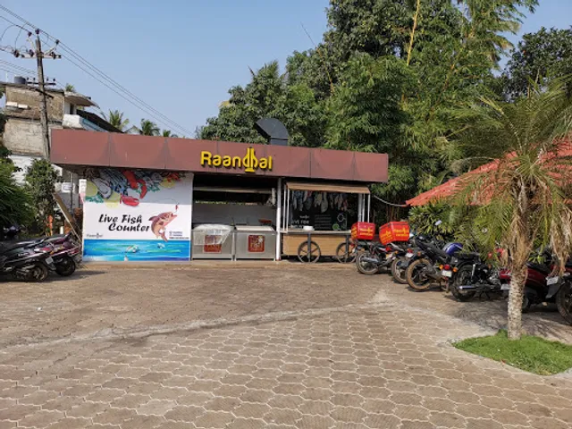
Raandhal Restaurant
3.8
(3.3K)
Closed
Click for details
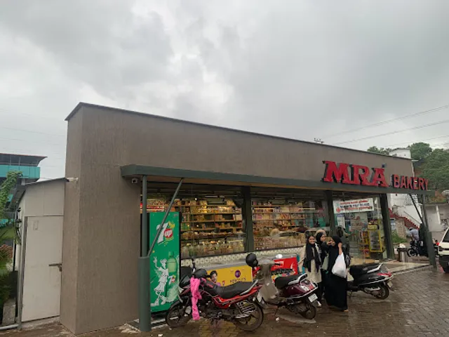
MRA Bakery & Restaurant
4.6
(2.3K)
$$
Closed
Click for details
Rara Avis Restaurant
3.8
(2.8K)
Closed
Click for details
Local services of Kannur District
Parassinikkadavu Snake Park
Chootad Beach
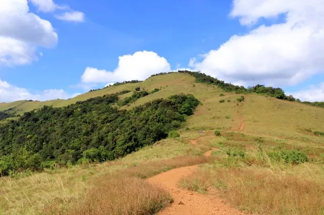
Paithalmala
Payyambalam Beach
Dharmadam Beach Park
Baby Beach
Dharmadam Beach
Muzhuppilangad Drive-in Beach
Peralassery Temple Pond
Tadiandamol
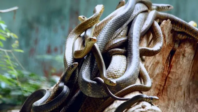
Parassinikkadavu Snake Park
4.0
(3.7K)
Click for details
Chootad Beach
4.2
(1.5K)
Click for details
Paithalmala
4.5
(1.0K)
Click for details
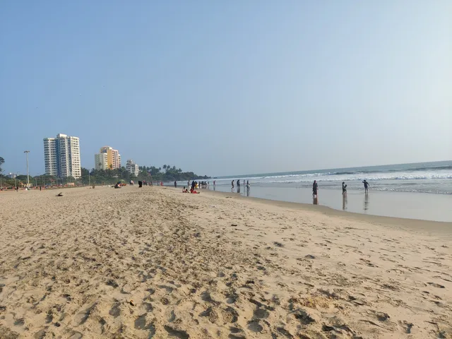
Payyambalam Beach
4.4
(1.0K)
Click for details

