Cactus to Clouds Trailhead things to do, attractions, restaurants, events info and trip planning
Basic Info
Cactus to Clouds Trailhead
Skyline Trail, Palm Springs, CA 92262
4.7(174)
Closed
Save
spot
spot
Ratings & Description
Info
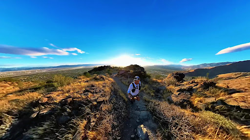
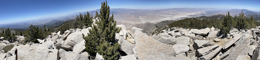
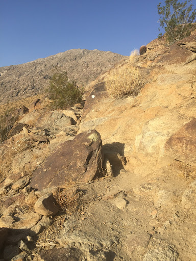
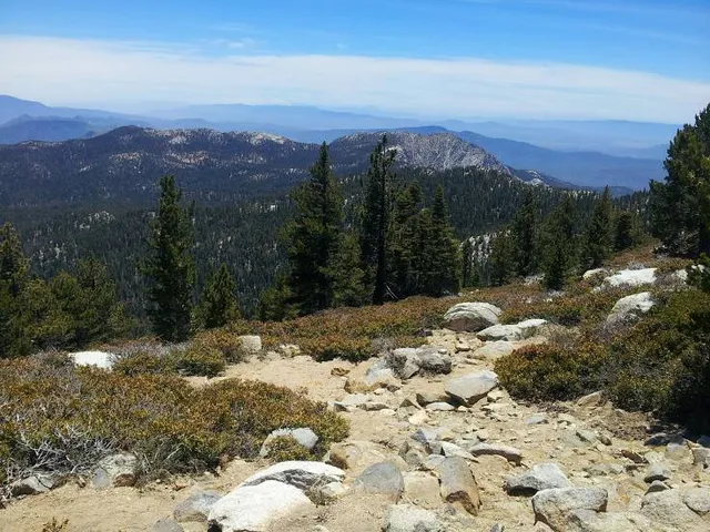
The Cactus to Clouds Trail is a hiking route in California. It begins in Palm Springs, California, and ascends to San Jacinto Peak. With a net elevation gain of roughly 10,300 feet, it has one of the greatest elevation increases among day-hike routes in the United States.
Outdoor
Adventure
Scenic
attractions: Museum Trail, Forever Marilyn, Annenberg Theater, Palm Springs Art Museum, Downtown Park, Marilyn Monroe Statue in Palm Springs, Walk of the Stars Palm Springs, Frey House II, Isabelle by Julian Voss-Andreae, Agua Caliente Cultural Museum, restaurants: Livs Palm Springs, Le Vallauris Restaurant, Bongo Johnny's Patio Bar & Grill, Tommy Bahama Marlin Bar, Santorini Gyro Palm Springs, The Sandwich Spot - Palm Springs, CA, The Tonga Hut Restaurant and Tiki Bar, Ponzu Sushi - Palm Springs, Il Corso - Palm Springs, Juniper Table, local businesses: The O'Donnell Golf Club, Crystal Fantasy, west elm, SEPHORA, Verizon, Palm Springs Vinyl Records and Collectibles, Town & Country Center, Power Yoga Palm Springs, Kiehl's, Destination PSP
Phone
(760) 862-9984
Open hoursSee all hours
Sat8:30 AM - 4 PMClosed
Plan your stay

Pet-friendly Hotels in Palm Springs
Find a cozy hotel nearby and make it a full experience.

Affordable Hotels in Palm Springs
Find a cozy hotel nearby and make it a full experience.

The Coolest Hotels You Haven't Heard Of (Yet)
Find a cozy hotel nearby and make it a full experience.

Trending Stays Worth the Hype in Palm Springs
Find a cozy hotel nearby and make it a full experience.
Reviews
Live events

Soak in a private desert hot spring retreat
Sun, Feb 22 • 6:00 AM
Desert Hot Springs, California, 92241
View details

Ride through the iconic neighborhoods of the..
Mon, Feb 23 • 8:30 AM
Palm Springs, California, 92264
View details
Nearby attractions of Cactus to Clouds Trailhead
Museum Trail
Forever Marilyn
Annenberg Theater
Palm Springs Art Museum
Downtown Park
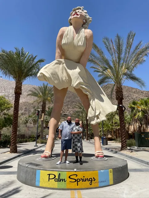
Marilyn Monroe Statue in Palm Springs
Walk of the Stars Palm Springs
Frey House II
Isabelle by Julian Voss-Andreae
Agua Caliente Cultural Museum

Museum Trail
4.5
(52)
Open until 12:00 AM
Click for details
Forever Marilyn
4.8
(780)
Open 24 hours
Click for details

Annenberg Theater
4.7
(104)
Open 24 hours
Click for details

Palm Springs Art Museum
4.7
(102)
Closed
Click for details
Nearby restaurants of Cactus to Clouds Trailhead
Livs Palm Springs
Le Vallauris Restaurant
Bongo Johnny's Patio Bar & Grill
Tommy Bahama Marlin Bar
Santorini Gyro Palm Springs
The Sandwich Spot - Palm Springs, CA
The Tonga Hut Restaurant and Tiki Bar
Ponzu Sushi - Palm Springs
Il Corso - Palm Springs
Juniper Table
Livs Palm Springs
4.8
(37)
$$
Closed
Click for details

Le Vallauris Restaurant
4.6
(427)
$$$$
Closed
Click for details

Bongo Johnny's Patio Bar & Grill
4.4
(909)
$$
Closed
Click for details

Tommy Bahama Marlin Bar
4.7
(919)
$$
Closed
Click for details
Nearby local services of Cactus to Clouds Trailhead
The O'Donnell Golf Club
Crystal Fantasy
west elm
SEPHORA
Verizon
Palm Springs Vinyl Records and Collectibles
Town & Country Center
Power Yoga Palm Springs
Kiehl's
Destination PSP

The O'Donnell Golf Club
4.6
(29)
Click for details

Crystal Fantasy
4.7
(401)
Click for details

west elm
4.1
(89)
Click for details

SEPHORA
4.4
(90)
Click for details